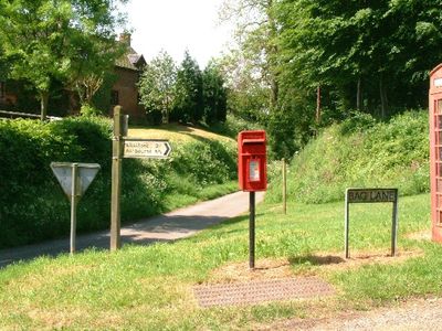
Norbury and Roston, civil parish in Derbyshire Dales district, Derbyshire, England
Posizione: Derbyshire Dales
Confina con: Snelston, Marston Montgomery, Cubley
Coordinate GPS: 52.97800,-1.81800
Ultimo aggiornamento: 6 marzo 2025 alle 01:54
Norbury Manor
82 m
Yeaveley Preceptory
5.4 km
St Mary and St Barlock's Church, Norbury
248 m
St John the Baptist's Church, Mayfield
4 km
Church of All Saints
2.7 km
Church of St Peter
3.4 km
Church of St Peter
1.3 km
Church of St Michael
3.2 km
Church of St Giles
4.6 km
Quixhill Bridge
2.5 km
Ellastone Bridge
334 m
Milepost Opposite Stone Bank
3 km
Village Cross And Drinking Fountain
2.8 km
The Manor House
4.6 km
Milepost At Ngr Sk 1148 4353
1.5 km
Rocester Bridge
3.2 km
Tutbury Mill
3.3 km
Milepost Approximately 10 Yards North West Of Red House At Ngr Sk 1400 4412
2.5 km
Milepost At Ngr Sk 1074 3992
2.8 km
Snelston War Memorial
3 km
Ousley Cross Base And Shaft At Ngr Sk 1255 4452
2.2 km
Milepost Approximately 50 Yards South West Of Prestwood Lane
1.6 km
Cross Approximately 15 Yards South Of South Aisle Of Church Of St John Baptist
3.9 km
Lychgate, Bus Stop And Connecting Retaining Wall To Churchyard
4.6 km
Milepost At Ngr Sk 1257 4360
1.3 km
Stubwood Methodist Chapel, Forecourt Walls, Railings And Gate
3.5 km
Milepost At Ngr Sk 1099 4123
1.7 km
Milepost, Denstone
3 kmHa visitato questo luogo? Tocchi le stelle per valutarlo e condividere la Sua esperienza o foto con la community! Provalo ora! Puoi annullarlo in qualsiasi momento.
Scopri tesori nascosti ad ogni viaggio!
Da piccoli caffè caratteristici a panorami nascosti, fuggi dalla folla e scova i posti che fanno davvero per te. La nostra app ti semplifica tutto: ricerca vocale, filtri furbi, percorsi ottimizzati e dritte autentiche da viaggiatori di tutto il mondo. Scaricala subito per vivere l'avventura sul tuo smartphone!
Un nuovo approccio alla scoperta turistica❞
— Le Figaro
Tutti i luoghi che meritano di essere esplorati❞
— France Info
Un’escursione su misura in pochi clic❞
— 20 Minutes