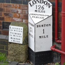
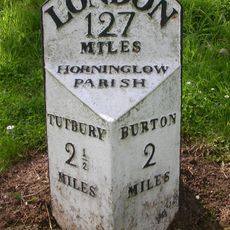
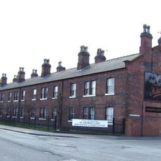
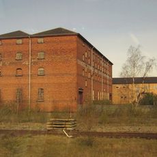
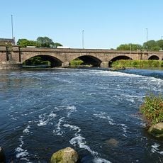
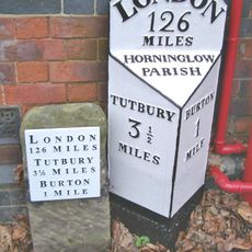
Horninglow and Eton, civil parish in East Staffordshire, Staffordshire, England
Posizione: East Staffordshire
Coordinate GPS: 52.82200,-1.64300
Ultimo aggiornamento: 4 aprile 2025 alle 04:52
National Brewery Centre
1.8 km
Claymills Pumping Station
2.3 km
St Paul's, Burton upon Trent
1.6 km
Burton upon Trent Town Hall
1.6 km
Roman Catholic Church of St Mary and St Modwen
2 km
The Burton Cooper
2.3 km
St John the Divine
200 mBurton Mill
2.3 km
St. Chad's Church
682 m
St Mary's, Stretton
1.8 km
167, Horninglow Street
1.9 km
Statue of Michael Arthur Bass
1.6 km
The Ritz
2 km
Milepost At Beam Hill Cross Roads (Ngr Sk2346125998)
1.2 km
Craythorne Hall (Now Includes Craythorne Grange)
2.1 km
Water Tower About 100 Metres To Rear Of Offices Of Bass's Brewery
2.3 km
Former Hydraulic Power House
1.1 km
Gaumont Burton-upon-Trent
2.3 km
Trent And Mersey Canal Milepost At Sk 259 260
2 km
Trent And Mersey Canal Milepost Off Shobnall Street At Sk 2363 2385
1.3 km
Milepost At Royal Oak Inn (Ngr Sk2433524765)
298 m
Former Midland Railway Grain Warehouse Number 2
1.7 km
Magistrates Court
1.8 km
Milepost, Tutbury Road, jct with BeamHill Road at Outwoods Cross
1.2 km
292-303, Shobnall Road
1.9 km
Pickford's Bonded Warehouse
1.1 km
Burton Bridge
2.2 km
Milepost, Horninglow Road North; by Royal Oak PH, just W of bypass flover
296 mHa visitato questo luogo? Tocchi le stelle per valutarlo e condividere la Sua esperienza o foto con la community! Provalo ora! Puoi annullarlo in qualsiasi momento.
Scopri tesori nascosti ad ogni viaggio!
Da piccoli caffè caratteristici a panorami nascosti, fuggi dalla folla e scova i posti che fanno davvero per te. La nostra app ti semplifica tutto: ricerca vocale, filtri furbi, percorsi ottimizzati e dritte autentiche da viaggiatori di tutto il mondo. Scaricala subito per vivere l'avventura sul tuo smartphone!
Un nuovo approccio alla scoperta turistica❞
— Le Figaro
Tutti i luoghi che meritano di essere esplorati❞
— France Info
Un’escursione su misura in pochi clic❞
— 20 Minutes