
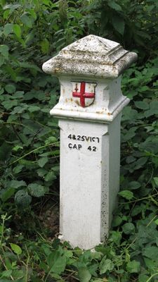
London Coal Duty Marker On County Boundary About 150 Metres South East Of Woodcock Hill Farm House
London Coal Duty Marker On County Boundary About 150 Metres South East Of Woodcock Hill Farm House, coal-tax post in Hillingdon, Greater London, UK
Posizione: London Borough of Hillingdon
Parte di: political border
Coordinate GPS: 51.61404,-0.46236
Ultimo aggiornamento: 4 marzo 2025 alle 11:14

Moor Park
1.9 km
Old Park Wood
2 km
Holy Trinity Church
1.7 km
Mount Vernon Hospital Chapel
1.3 km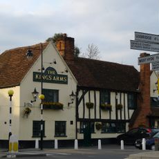
The King's Arms Public House
1.7 km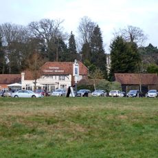
Ye Old Greene Manne Public House
1.4 km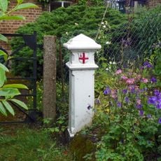
London Coal Duty Marker On Towing Path About 10 Metres South East Of Stocker's House
2.2 km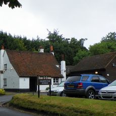
Rose And Crown Public House
854 m
Mount Vernon Hospital
1.1 km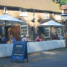
The Gate Public House
1.6 km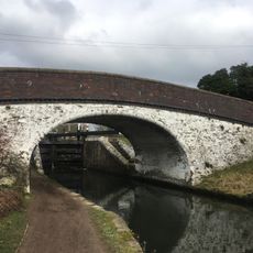
Bridge Number 175 At Stocker's Lock
2.2 km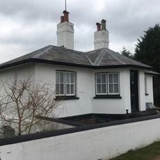
Stockers Lock House
2.2 km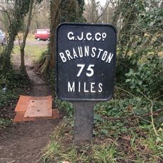
Mile Post On Towing Path About 600 Metres North East Of Stocker's Lock
2.2 km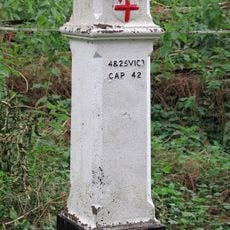
London Coal Duty Marker On Footpath On County Boundary About 880 Metres North West Of Wellington Grove (Not Listed)
1.8 km
Breakspear House
2.1 km
Stockers House
2.2 km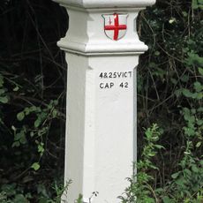
London Coal Duty Marker On County Boundary
1.4 km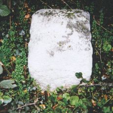
Milestone About 35 Metres West Of Number 1 Home Farm Road (Not Listed)
1.3 km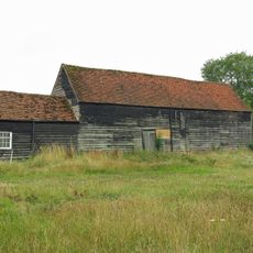
Barn And Cart Shed About 35 Metres North North West Of Stocker's Farm House
2.2 km
London Coal Duty Marker On County Boundary About 140 Metres South Of Road
2.3 km
17, Moor Lane
2.3 km
21 And 25, Harefield Road
2.2 km
Harefield Park
1.8 km
Barn About 25 Metres North West Of Stocker's Farm House
2.1 km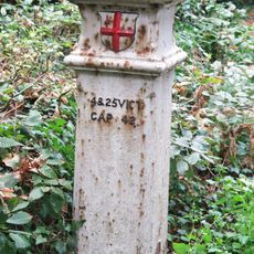
Coal And Wine Post Opposite High Lodge
900 m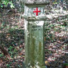
London Coal and Wine Duty boundary post
1.9 km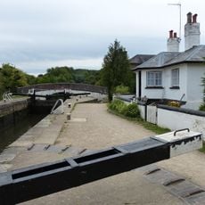
Stockers Lock Number 82
2.2 km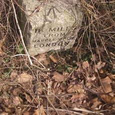
Milestone, Rickmansworth Road, opp eastern entrance to Mount Vernon Hospital
1.4 kmRecensioni
Ha visitato questo luogo? Tocchi le stelle per valutarlo e condividere la Sua esperienza o foto con la community! Provalo ora! Puoi annullarlo in qualsiasi momento.
Scopri tesori nascosti ad ogni viaggio!
Da piccoli caffè caratteristici a panorami nascosti, fuggi dalla folla e scova i posti che fanno davvero per te. La nostra app ti semplifica tutto: ricerca vocale, filtri furbi, percorsi ottimizzati e dritte autentiche da viaggiatori di tutto il mondo. Scaricala subito per vivere l'avventura sul tuo smartphone!

Un nuovo approccio alla scoperta turistica❞
— Le Figaro
Tutti i luoghi che meritano di essere esplorati❞
— France Info
Un’escursione su misura in pochi clic❞
— 20 Minutes