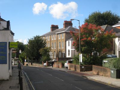
Leatherhead, town in Surrey, England
Posizione: Mole Valley
Sito web: http://www.molevalley.gov.uk
Confina con: Chessington
Sito web: http://molevalley.gov.uk
Coordinate GPS: 51.29510,-0.32890
Ultimo aggiornamento: 8 marzo 2025 alle 17:55
Cherkley Court
2.3 km
Bocketts Farm
1.8 km
Fetcham Park House
1.8 km
Ashtead Common
3.2 km
The Running Horse
234 m
Leatherhead Theatre
33 m
Church of Our Lady and St Peter, Leatherhead
623 m
Mole Gap to Reigate Escarpment
2.5 km
Church of St. Mary & St. Nicholas, Leatherhead
310 m
Church of St. Mary, Fetcham
1.9 km
Wesley House, With Steps And Walls To Front
223 m
Church of St Giles, Ashtead
3.1 km
Church of St Michael
3.1 km
The Running Horses Inn
3.1 km
Leatherhead Bridge
327 m
The Anchor Inn
3.1 km
Ashtead War Memorial
2.5 km
Thorncroft Manor
588 m
War Memorial
143 m
Milestone
765 m
Headley Court And Attached Former Stables
3.2 km
Leatherhead Museum
119 m
St John's School War Memorial, Leatherhead
452 m
Railway Viaduct Approximately 15 Metres West Of Road Bridge Over River Mole
440 m
2, Bridge Street
81 m
The Old House
2.9 km
33 And 35, High Street
70 m
Box Hill School
2.9 kmRecensioni
Ha visitato questo luogo? Tocchi le stelle per valutarlo e condividere la Sua esperienza o foto con la community! Provalo ora! Puoi annullarlo in qualsiasi momento.
Scopri tesori nascosti ad ogni viaggio!
Da piccoli caffè caratteristici a panorami nascosti, fuggi dalla folla e scova i posti che fanno davvero per te. La nostra app ti semplifica tutto: ricerca vocale, filtri furbi, percorsi ottimizzati e dritte autentiche da viaggiatori di tutto il mondo. Scaricala subito per vivere l'avventura sul tuo smartphone!
Un nuovo approccio alla scoperta turistica❞
— Le Figaro
Tutti i luoghi che meritano di essere esplorati❞
— France Info
Un’escursione su misura in pochi clic❞
— 20 Minutes