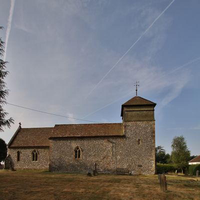
Nuffield, village and civil parish in South Oxfordshire, England
Posizione: South Oxfordshire
Confina con: Ewelme, Benson, Crowmarsh, Ipsden, Stoke Row, Highmoor, Nettlebed, Swyncombe
Sito web: http://nuffieldparish.org
Coordinate GPS: 51.58200,-1.03600
Ultimo aggiornamento: 9 marzo 2025 alle 17:07
Braziers Park
4.6 km
Nuffield Place
1 km
St Peter and St Paul, Checkendon
4.4 km
Nuffield Place (National Trust)
1.1 km
The White Hart Hotel
3.2 km
The Crooked Billet Public House
3.5 km
Church of St Mary
3.9 km
Church of the Holy Trinity
170 m
Church of St Bartholomew, Nettlebed
3 km
Church of St Botolph
3.1 km
Church of St John the Evangelist
3.6 km
Stoke Row Independent Chapel
3.8 km
The Crown Public House
683 m
Maharajah's Well
3.5 km
Nettlebed Kiln
3.3 km
Ipsden war memorial
4 km
Myrtles
3.2 km
The Old Vicarage
4.1 km
Howberry Wood Farmhouse
2.6 km
English Farmhouse
1.6 km
1 and 3, High Street
3.3 km
25, High Street
3.2 km
7, High Street
3.3 km
Grim's Ditch; portion from Mongewell Park Lodge to S of Nuffield church
2.6 km
Checkendon War Memorial Lychgate
4.5 km
Howberry Wood Farm, Granary Approximately 5 Metres East Of Farmhouse
2.6 km
Milestone, High Street; W of church, E of petrol station
2.9 km
Milestone, Port Hill; 20m W of lane to Hayden Farm
1.5 kmRecensioni
Ha visitato questo luogo? Tocchi le stelle per valutarlo e condividere la Sua esperienza o foto con la community! Provalo ora! Puoi annullarlo in qualsiasi momento.
Scopri tesori nascosti ad ogni viaggio!
Da piccoli caffè caratteristici a panorami nascosti, fuggi dalla folla e scova i posti che fanno davvero per te. La nostra app ti semplifica tutto: ricerca vocale, filtri furbi, percorsi ottimizzati e dritte autentiche da viaggiatori di tutto il mondo. Scaricala subito per vivere l'avventura sul tuo smartphone!
Un nuovo approccio alla scoperta turistica❞
— Le Figaro
Tutti i luoghi che meritano di essere esplorati❞
— France Info
Un’escursione su misura in pochi clic❞
— 20 Minutes