
The Meadows, architectural structure in Croxdale and Hett, County Durham, UK
Posizione: Croxdale and Hett
Coordinate GPS: 54.73309,-1.58316
Ultimo aggiornamento: 25 novembre 2023 alle 01:28
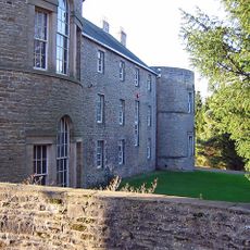
Croxdale Hall
449 m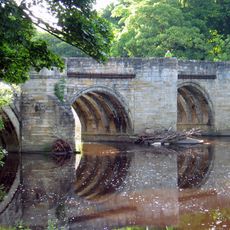
Sunderland Bridge
432 m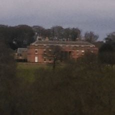
Burn Hall
1.3 km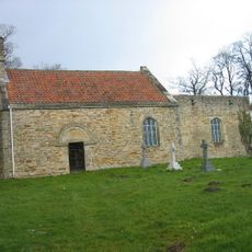
Croxdale church
536 m
Church 50 metres north east of Croxdale Hall
531 m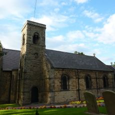
Church of St Bartholomew
246 m
Cross Shaft Base 8 Metres South Of Church To North East Of Croxdale Hall
530 m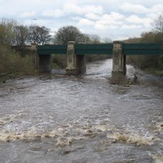
Croxdale Road Bridge
370 m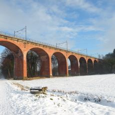
Croxdale Viaduct
618 m
Bridge 170 Metres North Of The Mill House
346 m
South Courtyard Range And Cottage, To East Of Croxdale Hall
475 m
The Mill House
198 m
Priests House 90 Metres East Of Croxdale Hall
535 m
Garden Wall And Gates To South East Of Croxdale Hall
493 m
North And East Courtyard Ranges And Walls, To East Of Croxdale Hall
517 m
Bank House Farmhouse
296 m
Barn At East Farm 30 Metres North West Of The Hermitage
37 m
The Hermitage
66 m
Haybarn and Rear Yard Walls 110 Metres East of Croxdale Hall
561 m
Orangery, Walls And Gate Piers To East Of Croxdale Hall
715 m
Willow Arbour
870 m
Willow Miner's Wife
953 m
Plant for the Future
998 m
1-20, Front Street
1.1 km
Gateway And Railings To East Of Burn Hall
1.1 km
Stepping Stones
1.2 km
Ha-Ha Wall, To South Of Burn Hall
1.3 km
Gazebo, Gate Piers And Garden Walls To East And South Of The Hermitage
83 mRecensioni
Ha visitato questo luogo? Tocchi le stelle per valutarlo e condividere la Sua esperienza o foto con la community! Provalo ora! Puoi annullarlo in qualsiasi momento.
Scopri tesori nascosti ad ogni viaggio!
Da piccoli caffè caratteristici a panorami nascosti, fuggi dalla folla e scova i posti che fanno davvero per te. La nostra app ti semplifica tutto: ricerca vocale, filtri furbi, percorsi ottimizzati e dritte autentiche da viaggiatori di tutto il mondo. Scaricala subito per vivere l'avventura sul tuo smartphone!

Un nuovo approccio alla scoperta turistica❞
— Le Figaro
Tutti i luoghi che meritano di essere esplorati❞
— France Info
Un’escursione su misura in pochi clic❞
— 20 Minutes