
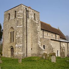
St Cyriac, architectural structure in Brabourne, Ashford, Kent, UK
Posizione: Brabourne
Coordinate GPS: 51.13627,1.00614
Ultimo aggiornamento: 25 novembre 2023 alle 01:29
Church of St Mary
78 m
Court Cottage
1.3 km
Bowl barrow 90m north of Stowting Court
1.5 km
Stowting Court
1.4 km
Malthouse And Oast With Wall And Gate About 15 Metres West And South West Of Ivy Cottage
495 m
Barn About 20 Metres South West Of Penstock Hall
585 m
Applegarth (The Former Post Office)
415 m
Ivy Cottage
465 m
Courtyard And Building Immediately To East Of And Adjoining Court Lodge
88 m
Court Lodge And Courtyard To Rear
108 m
Barn About 50 Metres South West Of Court Lodge (Tr 102 418)
198 m
Hill View
241 m
1-3, the Street
392 m
Church Farmhouse
55 m
The Five Bells
427 m
K6 Telephone Kiosk
445 m
Egerton Cottages
453 m
Group Of 4 Headstones 10 To 15 Metres North West Of Church Of St Mary
69 m
Headstone To Ann Caistor, About 25 Metres North Of Church Of St Mary
52 m
Penstock Hall
557 m
Barn About 10 Metres South Of Penstock Hall
558 m
Parsonage Farmhouse
51 m
Idenborough
989 m
Gates And Railings To Brabourne Churchyard Between Coquet Lodge And Church Farmhouse
44 m
Barn And Oasthouse At Tr092424
1.3 km
Barn And Shed At Tr 091424
1.3 km
Coquet Lodge
34 m
Barn About 50 Metres South East Of Stowting Court
1.5 kmRecensioni
Ha visitato questo luogo? Tocchi le stelle per valutarlo e condividere la Sua esperienza o foto con la community! Provalo ora! Puoi annullarlo in qualsiasi momento.
Scopri tesori nascosti ad ogni viaggio!
Da piccoli caffè caratteristici a panorami nascosti, fuggi dalla folla e scova i posti che fanno davvero per te. La nostra app ti semplifica tutto: ricerca vocale, filtri furbi, percorsi ottimizzati e dritte autentiche da viaggiatori di tutto il mondo. Scaricala subito per vivere l'avventura sul tuo smartphone!

Un nuovo approccio alla scoperta turistica❞
— Le Figaro
Tutti i luoghi che meritano di essere esplorati❞
— France Info
Un’escursione su misura in pochi clic❞
— 20 Minutes