
Elford House Including Boundary Wall To Street
Elford House Including Boundary Wall To Street, architectural structure in Ferring, Arun, West Sussex, UK
Posizione: Ferring
Coordinate GPS: 50.81847,-0.44626
Ultimo aggiornamento: 25 novembre 2023 alle 01:29
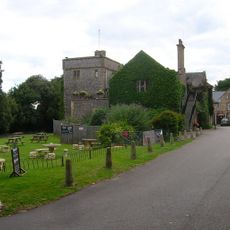
Sterns Nightclub
856 m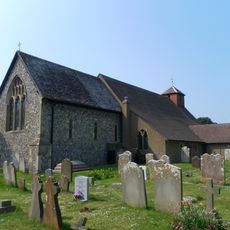
The Parish Church of St Andrew
677 m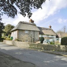
Evergreen Cottage Maytree Cottage
620 m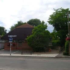
Ferring Library
485 m
Bramble Cottage
962 m
Hangelton Cottage Inglenook
433 m
Highdown Hill Camp: A Ram's Hill type enclosure, an Anglo-Saxon cemetery and associated remains
1.1 km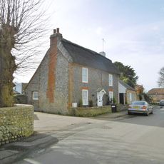
The Ramblers
652 m
Holly Lodge
634 m
Yew Tree Cottage
560 m
North Barn (Main Block) Including Wall Across The South, Bounding The Road
837 m
Church Cottage
634 m
3A Ferring Street
597 m
North Hangelton South Hangelton
467 m
The Old Barn
683 m
Home Farm House Home Farm Lodge
732 m
Home Farm Cottage
787 m
East Ferring House
792 m
Smugglers Cottage
606 m
Rose Cottage
345 m
North Barn (Range Of Outbuildings On East Side Of Yard)
866 m
Landalls Vine Cottage
317 m
Clematis Cottage Jasmine Cottage
267 m
Highdown Hill Camp
1.1 km
The Bull Inn
1.1 km
The Cottage
1.2 km
Hightiten Barn
1.2 km
Wall To Former Orchard North Of Goring Hall
1.3 kmRecensioni
Ha visitato questo luogo? Tocchi le stelle per valutarlo e condividere la Sua esperienza o foto con la community! Provalo ora! Puoi annullarlo in qualsiasi momento.
Scopri tesori nascosti ad ogni viaggio!
Da piccoli caffè caratteristici a panorami nascosti, fuggi dalla folla e scova i posti che fanno davvero per te. La nostra app ti semplifica tutto: ricerca vocale, filtri furbi, percorsi ottimizzati e dritte autentiche da viaggiatori di tutto il mondo. Scaricala subito per vivere l'avventura sul tuo smartphone!

Un nuovo approccio alla scoperta turistica❞
— Le Figaro
Tutti i luoghi che meritano di essere esplorati❞
— France Info
Un’escursione su misura in pochi clic❞
— 20 Minutes