
Castle Hill Farmhouse
Castle Hill Farmhouse, farmhouse in Capel, Tunbridge Wells, Kent, UK
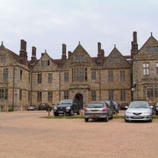
Somerhill House
1.5 km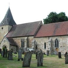
Old Church of St Peter
1.7 km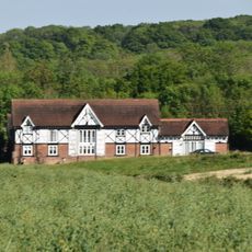
Milking Parlour And Cider House Immediately South Of Park Farmhouse
1.5 km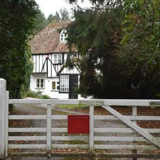
Fairthorne House
629 m
Fairthorne Cottage
660 m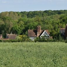
Park Farmhouse
1.5 km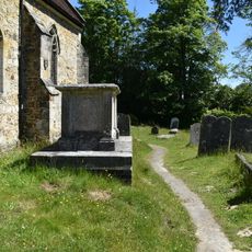
Anonymous Chest Tomb Approximately 1.5 Metres South Of The Nave Of The Old Church Of St Peter
1.7 km
Castle Hill earthworks, Tonbridge
351 m
Terrace Walls Around The South And East Sides Of Somerhill Including The Sunken Lake Approximately 5 Metres North Of The Somerhill Stable Yard
1.5 km
Yew Tree Farmhouse
1.2 km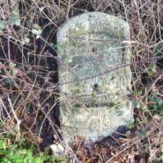
Milestone, Penbury Road, at jct with A21, in cul de sac of old road
1.6 km
Tudeley Woods RSPB reserve
522 m
Mancktell Headstone Approximately 2 Metres West Of The Tower Of The Old Church Of St Peter
1.6 km
Kenward
1.3 km
Castle Hill, Fort I
388 m
Turkey House About 25 Metres North East Of Park Farmhouse
1.5 km
Dairy About 10 Metres North Of Park Farmhouse
1.5 km
Barn Approximately 6 Metres North West Of Burgess Hill Farmhouse
386 m
Burgess Hill Farmhouse
364 m
Dislingbury Cottages
1.6 km
Milestone At Tq 612 422
1.5 km
Pair Of Hartridge Headstones Approximately 4 Metres West South West Of The Tower Of The Old Church Of St Peter
1.6 km
Weller Headstone Approximately 3 Metres South West Of The Tower Of The Old Church Of St Peter
1.7 km
Row Of 3 Driver Headstones Approximately 6 Metres South Of The Tower Of The Old Church Of St Peter
1.7 km
Hartniep Headstone Approximately 3 Metres South West Of The Porch Of The Old Church Of St Peter
1.7 km
Castle Hill, Fort II
359 m
Anonymous Chest Tomb Approximately 1.5 Metres South Of The Porch Of The Old Church Of St Peter
1.7 km
Top Lodge Including Front Boundary Fence
207 mRecensioni
Ha visitato questo luogo? Tocchi le stelle per valutarlo e condividere la Sua esperienza o foto con la community! Provalo ora! Puoi annullarlo in qualsiasi momento.
Scopri tesori nascosti ad ogni viaggio!
Da piccoli caffè caratteristici a panorami nascosti, fuggi dalla folla e scova i posti che fanno davvero per te. La nostra app ti semplifica tutto: ricerca vocale, filtri furbi, percorsi ottimizzati e dritte autentiche da viaggiatori di tutto il mondo. Scaricala subito per vivere l'avventura sul tuo smartphone!

Un nuovo approccio alla scoperta turistica❞
— Le Figaro
Tutti i luoghi che meritano di essere esplorati❞
— France Info
Un’escursione su misura in pochi clic❞
— 20 Minutes