
Ha-Ha Wall, To South Of Burn Hall, ha-ha in Durham, England, UK
Posizione: City of Durham
Coordinate GPS: 54.74215,-1.59652
Ultimo aggiornamento: 30 novembre 2025 alle 21:14
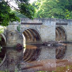
Sunderland Bridge
999 m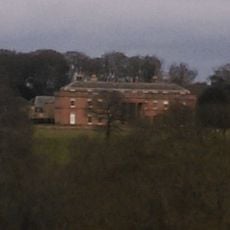
Burn Hall
30 m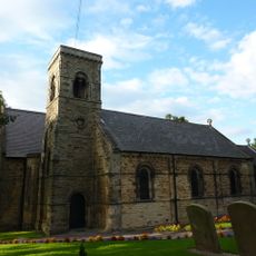
Church of St Bartholomew
1.2 km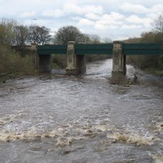
Croxdale Road Bridge
984 m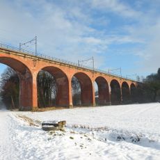
Croxdale Viaduct
1.1 km
Water Pump North West Of Burn Hall
327 m
Cottage North-West Of Low Burn Hall Farmhouse
970 m
Bridge 170 Metres North Of The Mill House
1.3 km
Farewell Hall West Farmhouse, Cottage And Farmbuildings Adjacent On North
1.2 km
Bank House Farmhouse
1.2 km
Garden Wall And Gate Piers, Adjoining Right Return Of Littleburn Farmhouse
733 m
Barn Adjoining Rear Of Left Wing Of Littleburn Farmhouse
771 m
Garden Wall North Of Burn Hall And Garden House Attached
362 m
Conservatory North West Of Burn Hall
306 m
Cow House Of Home Farm Burn Hall
321 m
Littleburn Farmhouse
750 m
Garden Scheme Offices North West Of Burn Hall
329 m
Ice-House To North-West Of Home Farm, Burn Hall
417 m
Gateway And Railings To East Of Burn Hall
475 m
Durham City Golf Course
545 m
Willow Tunnel
1.1 km
Stepping Stones
752 m
Willow Arbour
827 m
Willow Miner's Wife
1.1 km
Willow Miner
1.3 km
Plant for the Future
592 m
Miners Children
1.3 km
Punto di vista panoramico
1.1 kmRecensioni
Ha visitato questo luogo? Tocchi le stelle per valutarlo e condividere la Sua esperienza o foto con la community! Provalo ora! Puoi annullarlo in qualsiasi momento.
Scopri tesori nascosti ad ogni viaggio!
Da piccoli caffè caratteristici a panorami nascosti, fuggi dalla folla e scova i posti che fanno davvero per te. La nostra app ti semplifica tutto: ricerca vocale, filtri furbi, percorsi ottimizzati e dritte autentiche da viaggiatori di tutto il mondo. Scaricala subito per vivere l'avventura sul tuo smartphone!

Un nuovo approccio alla scoperta turistica❞
— Le Figaro
Tutti i luoghi che meritano di essere esplorati❞
— France Info
Un’escursione su misura in pochi clic❞
— 20 Minutes