
Field Head Farmhouse, farmhouse in Shotley Low Quarter, Northumberland, UK
Posizione: Shotley Low Quarter
Coordinate GPS: 54.86513,-1.88116
Ultimo aggiornamento: 25 novembre 2023 alle 01:32
Shotley Hall
1.2 km
Burn House, And Burn House Cottage
804 m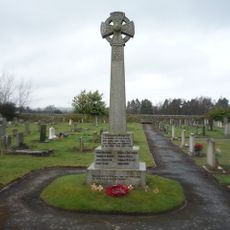
Shotley Low Quarter War Memorial
1.4 km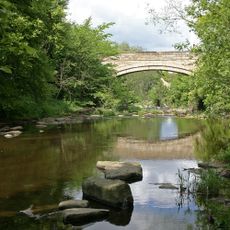
Shotley Bridge
1.4 km
Orchard House
1.4 km
Garden Pond West Of Grove House
986 m
Grove House and Azalea Court
1 km
Garden Ornament 6 Metres East Of South-East Corner Of Shotley Hall
1.2 km
Shotley Hall Stable Block And Attached Wall To South-West
1.2 km
Gate Piers To Shotley Hall, With Attached Forecourt Walls
1.2 km
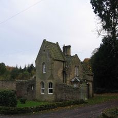
Gate Lodge To Shotley Hall
1.2 km
High Waskerley Farmhouse
1.3 km
Farmbuildings North And East Of High Waskerley Farmhouse
1.3 km
Piers And Wall To Garden To Garden Of Grove House
999 m
Church of St John
1.4 km
Walls In Front Of Numbers 22 To 24
1.4 km
22, 23 and 24 Cutlers' Hall Road
1.4 km
Lodge, Piers, Gate And Railings To Grove House
1 km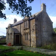
Forge Cottage
856 m
King's Head Hotel
1.5 km
Outbuilding South Of Messenger House
1.5 km
Messenger House
1.5 km
St Cuthbert's Vicarage
1.6 km
Walls And Piers In Front Of St Cuthbert's Vicarage
1.6 km
Church of St Cuthbert
1.6 km
Lloyd's Bank
1.6 km
Gate Piers In Front Of St Cuthbert's School
1.6 km
St Cuthbert's School
1.6 kmRecensioni
Ha visitato questo luogo? Tocchi le stelle per valutarlo e condividere la Sua esperienza o foto con la community! Provalo ora! Puoi annullarlo in qualsiasi momento.
Scopri tesori nascosti ad ogni viaggio!
Da piccoli caffè caratteristici a panorami nascosti, fuggi dalla folla e scova i posti che fanno davvero per te. La nostra app ti semplifica tutto: ricerca vocale, filtri furbi, percorsi ottimizzati e dritte autentiche da viaggiatori di tutto il mondo. Scaricala subito per vivere l'avventura sul tuo smartphone!

Un nuovo approccio alla scoperta turistica❞
— Le Figaro
Tutti i luoghi che meritano di essere esplorati❞
— France Info
Un’escursione su misura in pochi clic❞
— 20 Minutes