
662, High Road N17, building in Haringey, Greater London, UK
Posizione: London Borough of Haringey
Coordinate GPS: 51.59953,-0.06765
Ultimo aggiornamento: 25 novembre 2023 alle 01:33
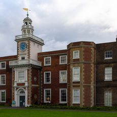
Bruce Castle
529 m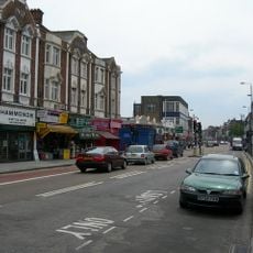
Tottenham High Road
131 m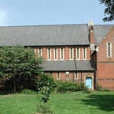
Church of St Mary the Virgin
132 m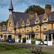
Chapel At Drapers' Almshouses The Drapers' Almshouses
439 m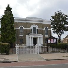
Tottenham Baptist Church
207 m
South Boundary Wall To Bruce Castle Park
443 m
Fronting To Chapel Stores
216 m
Fronting To Church Road
299 m
15A, Bruce Grove N17
534 m
Lodge To South East Of Draper's Almshouses
460 m
Southern Gate Building At Whitbread's Brewery
59 m
Charlton Cottage
385 m
Walls In Front Of Numbers 583 And 585
358 m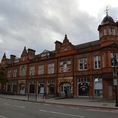
639, High Road N17
74 m
668 And 668A, High Road N17
19 m
583 And 585, High Road N17
372 m
2, King's Road N17
250 m
8-18, Lordship Lane N17
172 m
15 And 16, Bruce Grove N17
529 m
664 And 666, High Road N17
8 m
Wall To North Of Garden Of Number 16 Fronting The Avenue
525 m
670, High Road N17
58 m
695 And 697, High Road N17
173 m
774, High Road N17
520 m
Hotspur Cinema
326 m
Tottenham Magistrates Court
407 m
Walls Along South Boundary Of Number 581 And Around Back Gardens Of Numbers 581, 583 And 585
390 m
Studios 5, 6, 7, 8
530 mRecensioni
Ha visitato questo luogo? Tocchi le stelle per valutarlo e condividere la Sua esperienza o foto con la community! Provalo ora! Puoi annullarlo in qualsiasi momento.
Scopri tesori nascosti ad ogni viaggio!
Da piccoli caffè caratteristici a panorami nascosti, fuggi dalla folla e scova i posti che fanno davvero per te. La nostra app ti semplifica tutto: ricerca vocale, filtri furbi, percorsi ottimizzati e dritte autentiche da viaggiatori di tutto il mondo. Scaricala subito per vivere l'avventura sul tuo smartphone!

Un nuovo approccio alla scoperta turistica❞
— Le Figaro
Tutti i luoghi che meritano di essere esplorati❞
— France Info
Un’escursione su misura in pochi clic❞
— 20 Minutes