Durham City Golf Course
Posizione: County Durham
Coordinate GPS: 54.74690,-1.59853
Ultimo aggiornamento: 25 novembre 2025 alle 12:15
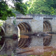
Sunderland Bridge
1.5 km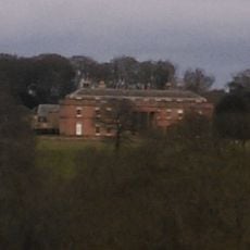
Burn Hall
521 m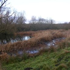
Butterby Oxbow
1.6 km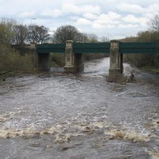
Croxdale Road Bridge
1.5 km
Water Pump North West Of Burn Hall
263 m
Cottage North-West Of Low Burn Hall Farmhouse
894 m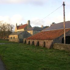
Low Butterby Farmhouse And Barn Adjoining At South-east
1.6 km
Farewell Hall West Farmhouse, Cottage And Farmbuildings Adjacent On North
787 m
Conservatory North West Of Burn Hall
266 m
Garden Wall North Of Burn Hall And Garden House Attached
204 m
Barn Adjoining Rear Of Left Wing Of Littleburn Farmhouse
363 m
Garden Wall And Gate Piers, Adjoining Right Return Of Littleburn Farmhouse
328 m
Cow House Of Home Farm Burn Hall
413 m
Moated site at Low Butterby Farm
1.6 km
Littleburn Farmhouse
345 m
Garden Scheme Offices North West Of Burn Hall
235 m
Ha-Ha Wall, To South Of Burn Hall
545 m
Gateway And Railings To East Of Burn Hall
785 m
Stone Circle
1.1 km
Stone Spiral
1.4 km
Willow Tunnel
843 m
Stepping Stones
901 m
Willow Arbour
1.2 km
Willow Miner's Wife
1.3 km
Willow Miner
994 m
Plant for the Future
922 m
Miners Children
1 km
Punto di vista panoramico
892 mRecensioni
Ha visitato questo luogo? Tocchi le stelle per valutarlo e condividere la Sua esperienza o foto con la community! Provalo ora! Puoi annullarlo in qualsiasi momento.
Scopri tesori nascosti ad ogni viaggio!
Da piccoli caffè caratteristici a panorami nascosti, fuggi dalla folla e scova i posti che fanno davvero per te. La nostra app ti semplifica tutto: ricerca vocale, filtri furbi, percorsi ottimizzati e dritte autentiche da viaggiatori di tutto il mondo. Scaricala subito per vivere l'avventura sul tuo smartphone!

Un nuovo approccio alla scoperta turistica❞
— Le Figaro
Tutti i luoghi che meritano di essere esplorati❞
— France Info
Un’escursione su misura in pochi clic❞
— 20 Minutes