Attiva posizione

Abbiamo bisogno della tua posizione per mostrarti luoghi interessanti intorno a te

Scopri luoghi nelle vicinanze

Trova luoghi interessanti e gemme nascoste intorno a te

Indicazioni precise

Ottieni indicazioni precise e distanze verso i luoghi

La tua posizione non viene mai condivisa con altri utenti. Viene utilizzata solo quando tocchi il pulsante posizione.

Heversham

Accedi al tuo account

Inizia a esplorare — è gratis

Scelto da 62.460 viaggiatori nel mondo

Continua con Google
Continua con Apple
o

Ti invieremo un codice per connetterti

Continuando, accetti i nostri Termini e Condizioni e la nostra Informativa sulla Privacy

Controlla la tua casella di posta

Abbiamo inviato un codice PIN nella tua casella di posta. Inserisci il codice qui sotto.

Heversham

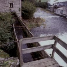
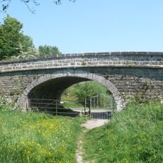
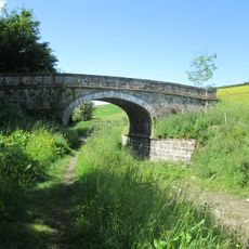
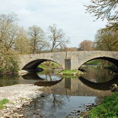
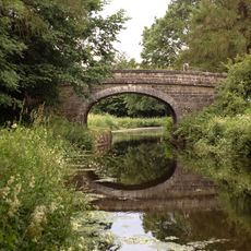
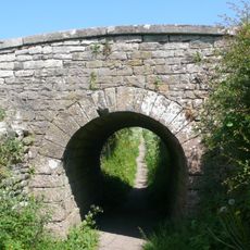
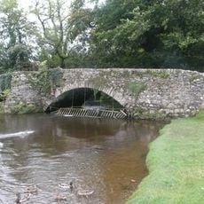
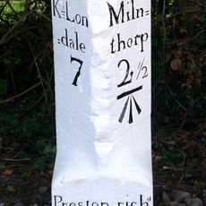
Heversham, village in the United Kingdom

La comunità dei viaggiatori curiosi

AroundUs riunisce migliaia di luoghi selezionati, consigli locali e gemme nascoste, arricchiti ogni giorno da oltre 60,000 contributori in tutto il mondo.

Inizia a esplorare
Posizione
Westmorland and Furness
Coordinate GPS
54.24316,-2.76940
Ultimo aggiornamento
3 marzo 2025 alle 20:27
Intorno a questo luogo
Levens Hall
Regno Unito

Levens Hall

1.8 km
Dallam Tower
Regno Unito

Dallam Tower

2.5 km
St Peter's Church, Heversham
Regno Unito

St Peter's Church, Heversham

359 m
Heron Corn Mill
Regno Unito

Heron Corn Mill

3.4 km
St Thomas' Church, Milnthorpe
Regno Unito

St Thomas' Church, Milnthorpe

1.8 km
Church of St John the Evangelist
Regno Unito

Church of St John the Evangelist

2.8 km
Stainton Crossing Bridge Over Kendal Lancaster Canal Ngr 5205 8543
Regno Unito

Stainton Crossing Bridge Over Kendal Lancaster Canal Ngr 5205 8543

3 km
Heversham War Memorial
Regno Unito

Heversham War Memorial

361 m
Lancaster Kendal Canal, Sellet Hall Bridge Over Lancaster/Kendal Canal
Regno Unito

Lancaster Kendal Canal, Sellet Hall Bridge Over Lancaster/Kendal Canal

2.8 km
Boundary Stone Opposite Leasgill Cottage
Regno Unito

Boundary Stone Opposite Leasgill Cottage

997 m
Levens Bridge
Regno Unito

Levens Bridge

1.9 km
Boundary Post At Junction Of B6384 With Paradise Lane Between Ackenthwaite And Whasset
Regno Unito

Boundary Post At Junction Of B6384 With Paradise Lane Between Ackenthwaite And Whasset

1.9 km
Levens War Memorial
Regno Unito

Levens War Memorial

2.8 km
Market Cross
Regno Unito

Market Cross

1.8 km
Kendal Lancaster Canal Mattinsons Bridge Ngr 5248 8395 Near Lane Farm Crooklands
Regno Unito

Kendal Lancaster Canal Mattinsons Bridge Ngr 5248 8395 Near Lane Farm Crooklands

2.6 km
Accommodation Bridge Over Sunken Horse Path 100 Yds East-South-East Of West Portal Of Hincaster Tunnel
Regno Unito

Accommodation Bridge Over Sunken Horse Path 100 Yds East-South-East Of West Portal Of Hincaster Tunnel

2 km
Footbridge over River Bela approximately 400 metres east-north-east of Milnthorpe Bridge
Regno Unito

Footbridge over River Bela approximately 400 metres east-north-east of Milnthorpe Bridge

2 km
Milestone Approximately 200 Yards South West Of Lane Farm
Regno Unito

Milestone Approximately 200 Yards South West Of Lane Farm

2.6 km
Railway Arch Over Sunken Horse Path And Retaining Walls To South West Of East Portal In Hincaster Tunnel
Regno Unito

Railway Arch Over Sunken Horse Path And Retaining Walls To South West Of East Portal In Hincaster Tunnel

2.2 km
West Portal To Hincaster Tunnel
Regno Unito

West Portal To Hincaster Tunnel

2 km
Boundary Stone At Entrance To Hawbarrow House
Regno Unito

Boundary Stone At Entrance To Hawbarrow House

831 m
Milestone Approximately 150 Meters North North West Of Junction With Paradise Lane North Of Beetham
Regno Unito

Milestone Approximately 150 Meters North North West Of Junction With Paradise Lane North Of Beetham

3.1 km
Boundary Stone At The Junction Off White Lane With The Woodhouse To Viver Road Approximately 300 Yards North Of Woodhouse
Regno Unito

Boundary Stone At The Junction Off White Lane With The Woodhouse To Viver Road Approximately 300 Yards North Of Woodhouse

1.3 km
Boundary Stone At The Junction Of Rowell Lane With Woodhouse To Ackenthwaite Road Approximately 600 Yards South Of Woodhouse
Regno Unito

Boundary Stone At The Junction Of Rowell Lane With Woodhouse To Ackenthwaite Road Approximately 600 Yards South Of Woodhouse

1.1 km
Milepost, Haverflatts, opp. St Anthony's House
Regno Unito

Milepost, Haverflatts, opp. St Anthony's House

956 m
Milepost, slip road from A590, S end of Levens Bridge, N of Lawrence House Farm
Regno Unito

Milepost, slip road from A590, S end of Levens Bridge, N of Lawrence House Farm

2.3 km
Milepost, Leasgill, by No.2 Milestone Cottage, High rise House
Regno Unito

Milepost, Leasgill, by No.2 Milestone Cottage, High rise House

704 m
Guidestone, Levens Hall
Regno Unito

Guidestone, Levens Hall

1.5 km
Mostra la mappa completa
« Heversham - village in the United Kingdom » è fornito da Around Us (it.aroundus.com). Le immagini e i testi sono tratti dal progetto Wikimedia con licenza Creative Commons. È possibile copiare, distribuire e modificare copie di questa pagina, alle condizioni stabilite dalla licenza, a condizione che questa nota sia chiaramente visibile.

Scopri tesori nascosti ad ogni viaggio!

Da piccoli caffè caratteristici a panorami nascosti, fuggi dalla folla e scova i posti che fanno davvero per te. La nostra app ti semplifica tutto: ricerca vocale, filtri furbi, percorsi ottimizzati e dritte autentiche da viaggiatori di tutto il mondo. Scaricala subito per vivere l'avventura sul tuo smartphone!

Around Us App Screenshot

Un nuovo approccio alla scoperta turistica

Le Figaro

Tutti i luoghi che meritano di essere esplorati

France Info

Un’escursione su misura in pochi clic

20 Minutes

Around Us
Guida di viaggio e mappe
Scarica

Invia al tuo telefono

QR Code
1

Apri l'app fotocamera sul tuo cellulare.

2

Inquadra il codice QR con la fotocamera. Apparirà una notifica.

3

Tocca la notifica per aprire il link.