Theydon Bois

Accedi al tuo account

AroundUs è una mappa collaborativa di luoghi interessanti, costruita da esploratori curiosi come te. Cresce con ogni recensione, storia e foto che condividi.
Accedi per salvare i tuoi posti preferiti, contribuire con nuovi luoghi e creare percorsi personalizzati.
Continua con Google
Continua con Apple
Continua con X
Continua con Facebook
Continua con email
Continuando, accetti i nostri Termini e Condizioni e la nostra Informativa sulla Privacy
Creare un account
Aggiungi alla collezione
Mappa
Suggerisci una modifica
Condividere

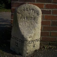
Theydon Bois, parrocchia civile inglese

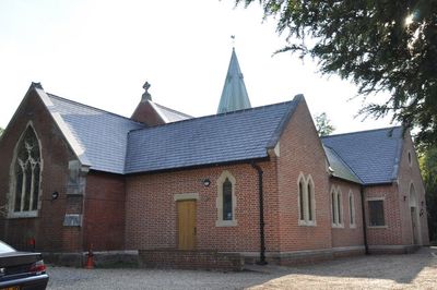
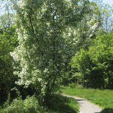
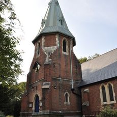
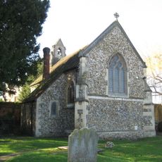
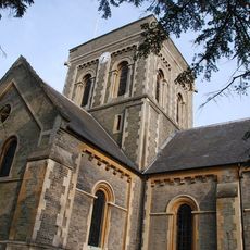
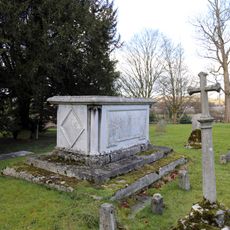
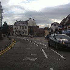
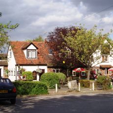
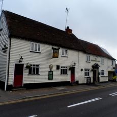
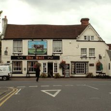
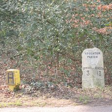
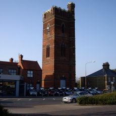
Theydon Bois è una parrocchia civile e un villaggio situato nella foresta di Epping vicino a Londra. L'insediamento si sviluppa lungo una strada principale fiancheggiata da case tradizionali, spazi aperti e negozi locali che formano il centro del villaggio.

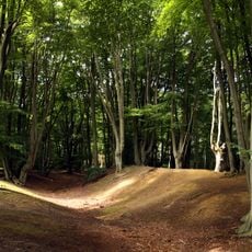
Il villaggio si è sviluppato nel corso dei secoli intorno alle terre forestali dell'Epping Forest, con l'insediamento strettamente legato all'uso dei boschi. La sua struttura moderna ha preso forma nel 19esimo secolo quando si è espansa l'infrastruttura.

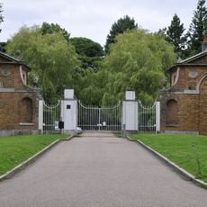
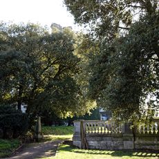
Il villaggio è facile da esplorare a piedi, poiché le principali attrazioni sono concentrate lungo la strada centrale. La sua vicinanza all'Epping Forest offre molte opportunità per passeggiate e attività all'aperto.

Posizione: Epping Forest

Sito web: http://theydon.org.uk

Coordinate GPS: 51.67130,0.10340

Ultimo aggiornamento: 14 dicembre 2025 alle 18:20

Foto
Intorno a questo luogo
Ambresbury Banks
Regno Unito

Ambresbury Banks

2.2 km
Loughton Hall
Regno Unito

Loughton Hall

3.1 km
Debden House
Regno Unito

Debden House

1.9 km
Home Mead
Regno Unito

Home Mead

2.1 km
Parish Church of St Mary
Regno Unito

Parish Church of St Mary

739 m
Church of St Nicholas
Regno Unito

Church of St Nicholas

3.1 km
St. John's Church
Regno Unito

St. John's Church

3.4 km
Church of All Saints Table Tomb In Churchyard Approximately 100 Feet North East Of Chancel To Sir Thomas Coxhead 1811
Regno Unito

Church of All Saints Table Tomb In Churchyard Approximately 100 Feet North East Of Chancel To Sir Thomas Coxhead 1811

1.7 km
Blue Boar Inn
Regno Unito

Blue Boar Inn

2.5 km
Holy Trinity Church
Regno Unito

Holy Trinity Church

2.5 km
Church of All Saints
Regno Unito

Church of All Saints

1.7 km
Queen Victoria Public House
Regno Unito

Queen Victoria Public House

266 m
The Maltsters Arms Public House
Regno Unito

The Maltsters Arms Public House

2.5 km
West Lodge, Gateway, East Lodge to London Entrance Drive to Copt Hall
Regno Unito

West Lodge, Gateway, East Lodge to London Entrance Drive to Copt Hall

2.9 km
The Bull Public House
Regno Unito

The Bull Public House

92 m
Milestone On West Side Opposite Gregson's Ride At Tq 429 982
Regno Unito

Milestone On West Side Opposite Gregson's Ride At Tq 429 982

2.8 km
Copped Hall Gardens
Regno Unito

Copped Hall Gardens

3.3 km
Parsonage Farmhouse
Regno Unito

Parsonage Farmhouse

378 m
Tomb 5 Metres East Of St Nicholas's Church, To Mary, Wife Of Joseph French Of Little Burstead, Essex, Died 1800
Regno Unito

Tomb 5 Metres East Of St Nicholas's Church, To Mary, Wife Of Joseph French Of Little Burstead, Essex, Died 1800

3 km
Church of All Saints Tombstone In Churchyard To Mrs E Rogers 1759 And R Rogers 1773
Regno Unito

Church of All Saints Tombstone In Churchyard To Mrs E Rogers 1759 And R Rogers 1773

1.7 km
Church of All Saints, Tombstone In Churchyard 60 Feet North Of Stair Tower
Regno Unito

Church of All Saints, Tombstone In Churchyard 60 Feet North Of Stair Tower

1.6 km
Water Tower
Regno Unito

Water Tower

2.8 km
Margaret Walker (1922-2013) founder of the East 15 Acting School and theatre workshop director Joan Littlewood (1914-2002) remembered here
Regno Unito

Margaret Walker (1922-2013) founder of the East 15 Acting School and theatre workshop director Joan Littlewood (1914-2002) remembered here

3 km
Milestone, 400m E of Upshire Road jct
Regno Unito

Milestone, 400m E of Upshire Road jct

2.3 km
Milestone, 400m E of Piggots Farm
Regno Unito

Milestone, 400m E of Piggots Farm

2 km
Milestone, Church Hill
Regno Unito

Milestone, Church Hill

3.6 km
Milestone, 20m E of roundabout
Regno Unito

Milestone, 20m E of roundabout

2.8 km
Milestone, High Road, opp jct with Bury Lane (B182)
Regno Unito

Milestone, High Road, opp jct with Bury Lane (B182)

2.5 km
Mostra la mappa completa
Recensioni

Ha visitato questo luogo? Tocchi le stelle per valutarlo e condividere la Sua esperienza o foto con la community! Provalo ora! Puoi annullarlo in qualsiasi momento.

« Theydon Bois - parrocchia civile inglese » è fornito da Around Us (it.aroundus.com). Le immagini e i testi sono tratti dal progetto Wikimedia con licenza Creative Commons. È possibile copiare, distribuire e modificare copie di questa pagina, alle condizioni stabilite dalla licenza, a condizione che questa nota sia chiaramente visibile.

Scopri tesori nascosti ad ogni viaggio!

Da piccoli caffè caratteristici a panorami nascosti, fuggi dalla folla e scova i posti che fanno davvero per te. La nostra app ti semplifica tutto: ricerca vocale, filtri furbi, percorsi ottimizzati e dritte autentiche da viaggiatori di tutto il mondo. Scaricala subito per vivere l'avventura sul tuo smartphone!

Around Us App Screenshot

Un nuovo approccio alla scoperta turistica

Le Figaro

Tutti i luoghi che meritano di essere esplorati

France Info

Un’escursione su misura in pochi clic

20 Minutes