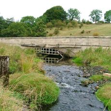
Gaunless Viaduct, Viadotto ferroviario a County Durham, Regno Unito.
Gaunless Viaduct attraversa il fiume Gaunless con quattro campate a traliccio sostenute da pile circolari in mattoni abbinati. La struttura e stata progettata per ospitare due binari ferroviari.
La struttura e stata progettata dall'ingegnere Thomas Bouch e aperta nel 1863 come parte di una linea ferroviaria che collegava Bishop Auckland a Barnard Castle. Ha rappresentato un passo importante per collegare questa regione remota della valle.
La struttura rappresenta lo sviluppo industriale del County Durham, dove le ferrovie collegavano le comunita e sostenevano l'estrazione del carbone. Mostra quanto fosse importante l'infrastruttura ferroviaria per la crescita economica della regione.
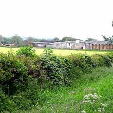
Il viadotto si trova in un ambiente rurale ed e meglio raggiungibile a piedi o in auto, con sentieri locali che facilitano l'accesso. L'area circostante offre percorsi a piedi aperti con buoni punti di vista della struttura.
Il progetto originale e stato costruito per ospitare due linee ferroviarie, ma inizialmente e stata posata solo una traccia. Questo mostra il pensiero pratico dell'epoca, consentendo un'espansione futura.
La comunità dei viaggiatori curiosi
AroundUs riunisce migliaia di luoghi selezionati, consigli locali e gemme nascoste, arricchiti ogni giorno da oltre 60,000 contributori in tutto il mondo.