Grey Wethers

Accedi al tuo account

AroundUs è una mappa collaborativa di luoghi interessanti, costruita da esploratori curiosi come te. Cresce con ogni recensione, storia e foto che condividi.
Accedi per salvare i tuoi posti preferiti, contribuire con nuovi luoghi e creare percorsi personalizzati.
Continua con Google
Continua con Apple
Continua con X
Continua con Facebook
Continua con email
Continuando, accetti i nostri Termini e Condizioni e la nostra Informativa sulla Privacy
Creare un account
Aggiungi alla collezione
Mappa
Suggerisci una modifica
Condividere

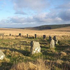
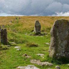
Grey Wethers, Cerchi di pietra dell'Età del Bronzo a Dartmoor, Inghilterra

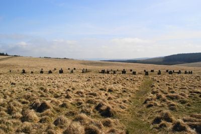
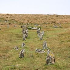
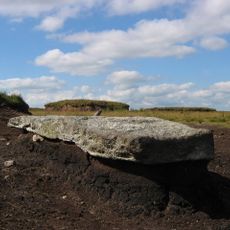
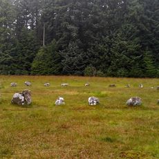
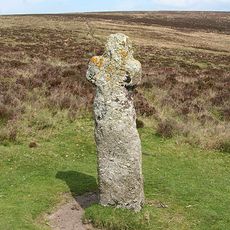
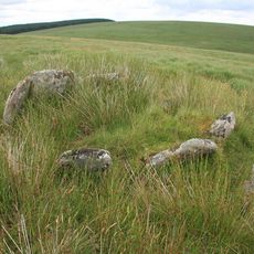
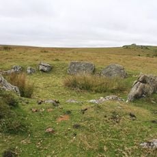
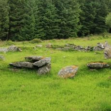
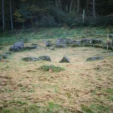
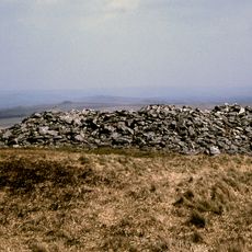
Grey Wethers consiste in due cerchi di pietra posizionati sulle alture di Dartmoor, ciascuno di circa 30 metri di diametro. Un cerchio contiene circa 20 pietre di granito mentre l'altro ne ha circa 30, formando anelli distintivi di massi erosi che rimangono intatti oggi.

Questi cerchi furono costruiti durante l'Età del Bronzo, con scavi che hanno rivelato depositi di carbone a livello del suolo all'interno di entrambi gli anelli. Il carbone suggerisce che le persone si riunivano qui per rituali legati al fuoco o cerimonie che avevano significato nella loro società.

Il nome deriva da come i pastori locali vedevano le pietre come pecore che apparivano nella nebbia, con 'wether' che è un'antica parola inglese per un montone castrato. Questo nome riflette il legame intimo tra le persone che vivevano sulla brughiera e il paesaggio che le circondava.

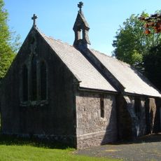
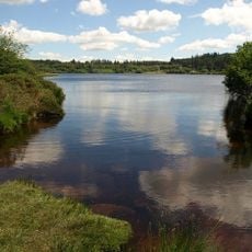
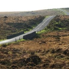
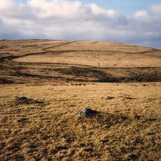
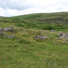
Il sito si trova su una brughiera aperta ed è raggiungibile da sentieri segnalati dal parcheggio di Fernworthy Forest attraverso un terreno ondulato. L'area è esposta agli elementi, quindi i visitatori devono prepararsi ai cambiamenti climatici e portare provviste poiché non ci sono rifuggi né strutture nelle vicinanze.

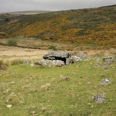
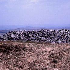
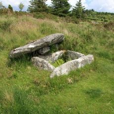
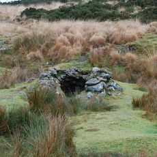
Questo sito si trova a un'elevazione più alta di qualsiasi altro monumento preistorico a Dartmoor e fa parte di un complesso più grande con diversi tumuli funebri nelle vicinanze. La combinazione di due grandi cerchi insieme a strutture minori aggiuntive ne fece un luogo di riunione speciale per le comunità antiche.

Posizione: Devon

Parte di: Two stone circles known as The Grey Wethers, three round cairns, two ring cairns and an oval enclosure in Great Stannon Newtake

Sito web: https://megalithic.co.uk/article.php?x=263950&y=83150

Coordinate GPS: 50.63196,-3.92620

Ultimo aggiornamento: 10 dicembre 2025 alle 21:01

Foto
Intorno a questo luogo
Cranmere Pool
Regno Unito

Cranmere Pool

4.4 km
Postbridge Clapper Bridge
Regno Unito

Postbridge Clapper Bridge

4.3 km
Shovel Down
Regno Unito

Shovel Down

3.2 km
Cut Hill Stone Row
Regno Unito

Cut Hill Stone Row

4 km
Fernworthy Circle
Regno Unito

Fernworthy Circle

1.9 km
Roundy Park prehistoric enclosure and cairn with cist, 560m north east of Archerton
Regno Unito

Roundy Park prehistoric enclosure and cairn with cist, 560m north east of Archerton

3.5 km
Teignhead Clapper Bridge
Regno Unito

Teignhead Clapper Bridge

1.3 km
Church of St Gabriel
Regno Unito

Church of St Gabriel

4.2 km
Fernworthy Reservoir
Regno Unito

Fernworthy Reservoir

2.9 km
Bennett's Cross
Regno Unito

Bennett's Cross

4.4 km
Two stone circles known as The Grey Wethers, three round cairns, two ring cairns and an oval enclosure in Great Stannon Newtake
Regno Unito

Two stone circles known as The Grey Wethers, three round cairns, two ring cairns and an oval enclosure in Great Stannon Newtake

167 m
Statts Bridge
Regno Unito

Statts Bridge

3.9 km
Stone alignment, cairns, enclosed prehistoric settlement and a length of reave on Hurston Ridge
Regno Unito

Stone alignment, cairns, enclosed prehistoric settlement and a length of reave on Hurston Ridge

3.5 km
Post Bridge
Regno Unito

Post Bridge

4.3 km
Milestone At Sx 678 813
Regno Unito

Milestone At Sx 678 813

4.3 km
Broadun prehistoric enclosed settlement, 780m NNW of Archerton
Regno Unito

Broadun prehistoric enclosed settlement, 780m NNW of Archerton

3.2 km
Kerbed cairn and cist 635m south west of The Grey Wethers
Regno Unito

Kerbed cairn and cist 635m south west of The Grey Wethers

635 m
Two stone hut circles and part of a coaxial field system at Frenchbeer Rock
Regno Unito

Two stone hut circles and part of a coaxial field system at Frenchbeer Rock

4 km
Round cairn 780m south of the Thirlstone
Regno Unito

Round cairn 780m south of the Thirlstone

3.1 km
Coaxial fields and prehistoric settlements 180m north and 350m north west of Hartland Tor
Regno Unito

Coaxial fields and prehistoric settlements 180m north and 350m north west of Hartland Tor

3 km
Stone alignment, hut circle settlement, medieval long house and post-medieval farmstead at Assycombe
Regno Unito

Stone alignment, hut circle settlement, medieval long house and post-medieval farmstead at Assycombe

2.1 km
Partially enclosed stone hut circle settlement 780m south west of Metherall
Regno Unito

Partially enclosed stone hut circle settlement 780m south west of Metherall

2.7 km
Cairn and cist on the northern side of Fernworthy Reservoir, 660m north west of Metherall
Regno Unito

Cairn and cist on the northern side of Fernworthy Reservoir, 660m north west of Metherall

3.1 km
The North Teign coaxial field system (western part) and associated later remains at Shovel Down, Stonetor Hill and Long Ridge
Regno Unito

The North Teign coaxial field system (western part) and associated later remains at Shovel Down, Stonetor Hill and Long Ridge

3.1 km
Round cairn on Watern Tor
Regno Unito

Round cairn on Watern Tor

3.8 km
Tinners' building in Great Stannon Newtake, 810m north west of Stannon Tor
Regno Unito

Tinners' building in Great Stannon Newtake, 810m north west of Stannon Tor

1.7 km
Milestone, Statts Bridge, 300m SW of bridge
Regno Unito

Milestone, Statts Bridge, 300m SW of bridge

3.8 km
Milestone, St Gabriel's Church, 80m NE of church, opp. Beechwood
Regno Unito

Milestone, St Gabriel's Church, 80m NE of church, opp. Beechwood

4.1 km
Mostra la mappa completa
Recensioni

Ha visitato questo luogo? Tocchi le stelle per valutarlo e condividere la Sua esperienza o foto con la community! Provalo ora! Puoi annullarlo in qualsiasi momento.

« Grey Wethers - Cerchi di pietra dell'Età del Bronzo a Dartmoor, Inghilterra » è fornito da Around Us (it.aroundus.com). Le immagini e i testi sono tratti dal progetto Wikimedia con licenza Creative Commons. È possibile copiare, distribuire e modificare copie di questa pagina, alle condizioni stabilite dalla licenza, a condizione che questa nota sia chiaramente visibile.

Scopri tesori nascosti ad ogni viaggio!

Da piccoli caffè caratteristici a panorami nascosti, fuggi dalla folla e scova i posti che fanno davvero per te. La nostra app ti semplifica tutto: ricerca vocale, filtri furbi, percorsi ottimizzati e dritte autentiche da viaggiatori di tutto il mondo. Scaricala subito per vivere l'avventura sul tuo smartphone!

Around Us App Screenshot

Un nuovo approccio alla scoperta turistica

Le Figaro

Tutti i luoghi che meritano di essere esplorati

France Info

Un’escursione su misura in pochi clic

20 Minutes