Maxstoke Priory

Accedi al tuo account

AroundUs è una mappa collaborativa di luoghi interessanti, costruita da esploratori curiosi come te. Cresce con ogni recensione, storia e foto che condividi.
Accedi per salvare i tuoi posti preferiti, contribuire con nuovi luoghi e creare percorsi personalizzati.
Continua con Google
Continua con Apple
Continua con X
Continua con Facebook
Continua con email
Continuando, accetti i nostri Termini e Condizioni e la nostra Informativa sulla Privacy
Creare un account
Aggiungi alla collezione
Mappa
Suggerisci una modifica
Condividere

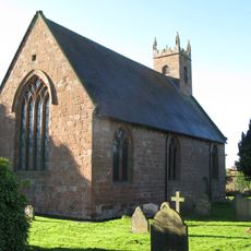
Maxstoke Priory, Rovine monastiche medievali a Maxstoke, Inghilterra

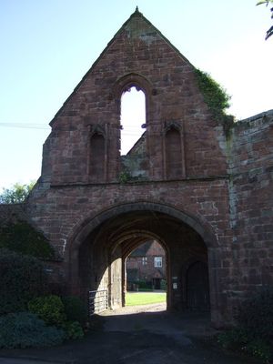
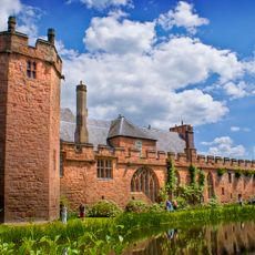
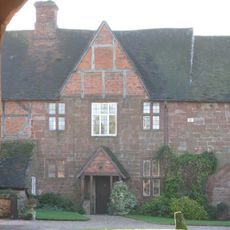
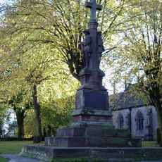
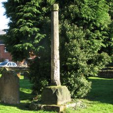
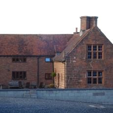
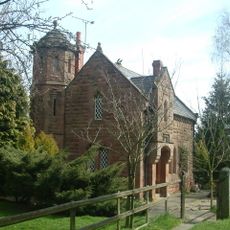
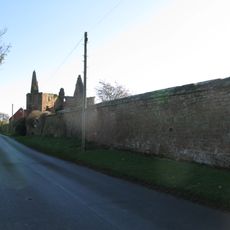
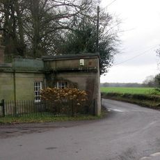
Il Priorato di Maxstoke consiste nei resti di pietra di un monastero medievale, con una torre centrale, due porte d'accesso e i resti dell'infermeria con dettagli architettonici del 14esimo secolo. Le strutture superstiti mostrano la disposizione tipica di un'istituzione agostiniana con aree funzionali distinte.

Sir William de Clinton ha fondato il sito nel 1330 come un collegio di sacerdoti, poi lo ha trasformato in un monastero agostiniano tramite approvazione reale nel 1336. Questo cambiamento ha segnato il passaggio da un'istituzione sacerdotale secolare a una comunita monastica formale.

Il monastero era un centro di educazione musicale e religiosa, con una scuola di canto e un organo che risuonava durante i servizi. Questo impegno nell'apprendimento e nella pratica musicale caratterizzava il ritmo quotidiano della comunita.

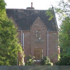
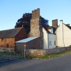
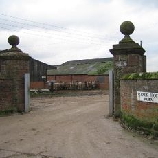
La porta interna funziona ora come casa d'ospiti, mentre la porta esterna fornisce accesso alle terre agricole circostanti. I visitatori possono esplorare le ruine passeggiando nel sito e osservando le diverse tracce di edifici.

Sopra la finestra centrale del portico esterno ci sono teste di pietra scolpite che rappresentano un cavaliere con visiera abbassata e un monaco. Queste rare sculture rivelano il legame tra il potere secolare e l'autorita religiosa che ha formato questo luogo.

Posizione: Maxstoke

Inizio: 1330s

Coordinate GPS: 52.47773,-1.65614

Ultimo aggiornamento: 14 dicembre 2025 alle 15:23

Foto
Intorno a questo luogo
Castello di Maxstoke
Regno Unito

Castello di Maxstoke

2.6 km
Packington Hall
Regno Unito

Packington Hall

3.1 km
Blyth Hall
Regno Unito

Blyth Hall

4.3 km
Church of St Peter and St Paul, Coleshill
Regno Unito

Church of St Peter and St Paul, Coleshill

4.1 km
St James' Church, Great Packington
Regno Unito

St James' Church, Great Packington

2.7 km
Packington Old Hall
Regno Unito

Packington Old Hall

2.1 km
Church of St Cuthbert, Shustoke
Regno Unito

Church of St Cuthbert, Shustoke

4.4 km
Church of St Michael and All Angels
Regno Unito

Church of St Michael and All Angels

216 m
Church of St Bartholomew
Regno Unito

Church of St Bartholomew

3.3 km
Little Packington Bridge
Regno Unito

Little Packington Bridge

2.3 km
Remains of Tower and Walls of Monastic Church Approximately 250 Metres South of Priory Farmhouse
Regno Unito

Remains of Tower and Walls of Monastic Church Approximately 250 Metres South of Priory Farmhouse

44 m
Blyth Bridge (That Part In Coleshill Civil Parish)
Regno Unito

Blyth Bridge (That Part In Coleshill Civil Parish)

3.9 km
Priory Farmhouse
Regno Unito

Priory Farmhouse

130 m
The Old Rectory
Regno Unito

The Old Rectory

155 m
Outer Gatehouse and Attached Precinct Walls and Barn 200 Metres North of Priory Farmhouse
Regno Unito

Outer Gatehouse and Attached Precinct Walls and Barn 200 Metres North of Priory Farmhouse

186 m
Meriden Cross
Regno Unito

Meriden Cross

4.5 km
Coleshill War Memorial, Warwickshire
Regno Unito

Coleshill War Memorial, Warwickshire

4.1 km
Churchyard cross, St Michael's churchyard
Regno Unito

Churchyard cross, St Michael's churchyard

216 m
Milepost Approximately 12 Metres North West Of Slowley Green Cottage (Not Included)
Regno Unito

Milepost Approximately 12 Metres North West Of Slowley Green Cottage (Not Included)

4.5 km
Stable Block, At Colliers Oak Farm
Regno Unito

Stable Block, At Colliers Oak Farm

2.5 km
Stone House Farmhouse
Regno Unito

Stone House Farmhouse

2.8 km
Gate Pier, East Side Of Entrance To Manor House Farm
Regno Unito

Gate Pier, East Side Of Entrance To Manor House Farm

3.4 km
Blythe Lodge
Regno Unito

Blythe Lodge

3.8 km
Gatepier, West Side Of Entrance To Manor House Farm
Regno Unito

Gatepier, West Side Of Entrance To Manor House Farm

3.4 km
Precinct Wall, 60 Metres Northwest of Old Rectory
Regno Unito

Precinct Wall, 60 Metres Northwest of Old Rectory

237 m
The Lodge At Fillongley Hall
Regno Unito

The Lodge At Fillongley Hall

3.8 km
1 and 2, the Thatched Cottages
Regno Unito

1 and 2, the Thatched Cottages

4.4 km
Precinct Wall, East of Outer Gatehouse and Bounding Churchyard of St Michael and All Saints on the West
Regno Unito

Precinct Wall, East of Outer Gatehouse and Bounding Churchyard of St Michael and All Saints on the West

205 m
Mostra la mappa completa
Recensioni

Ha visitato questo luogo? Tocchi le stelle per valutarlo e condividere la Sua esperienza o foto con la community! Provalo ora! Puoi annullarlo in qualsiasi momento.

« Maxstoke Priory - Rovine monastiche medievali a Maxstoke, Inghilterra » è fornito da Around Us (it.aroundus.com). Le immagini e i testi sono tratti dal progetto Wikimedia con licenza Creative Commons. È possibile copiare, distribuire e modificare copie di questa pagina, alle condizioni stabilite dalla licenza, a condizione che questa nota sia chiaramente visibile.

Scopri tesori nascosti ad ogni viaggio!

Da piccoli caffè caratteristici a panorami nascosti, fuggi dalla folla e scova i posti che fanno davvero per te. La nostra app ti semplifica tutto: ricerca vocale, filtri furbi, percorsi ottimizzati e dritte autentiche da viaggiatori di tutto il mondo. Scaricala subito per vivere l'avventura sul tuo smartphone!

Around Us App Screenshot

Un nuovo approccio alla scoperta turistica

Le Figaro

Tutti i luoghi che meritano di essere esplorati

France Info

Un’escursione su misura in pochi clic

20 Minutes