Lopwell

Accedi al tuo account

AroundUs è una mappa collaborativa di luoghi interessanti, costruita da esploratori curiosi come te. Cresce con ogni recensione, storia e foto che condividi.
Accedi per salvare i tuoi posti preferiti, contribuire con nuovi luoghi e creare percorsi personalizzati.
Continua con Google
Continua con Apple
Continua con X
Continua con Facebook
Continua con email
Continuando, accetti i nostri Termini e Condizioni e la nostra Informativa sulla Privacy
Creare un account
Aggiungi alla collezione
Mappa
Suggerisci una modifica
Condividere

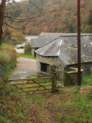
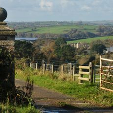
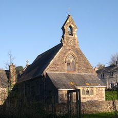
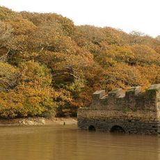
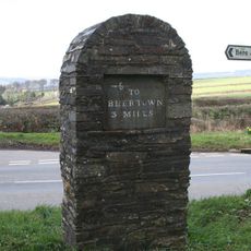
Lopwell, Riserva naturale a River Tavy, Devon, Inghilterra.

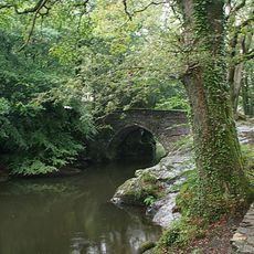
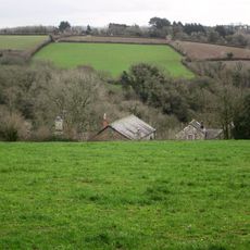
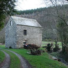
Lopwell è una riserva naturale protetta situata lungo il fiume Tavy vicino a Plymouth nel Devon. Contiene paludi salmastre, zone umide d'acqua dolce e boschi antichi collegati da sentieri che serpeggiamo attraverso ogni tipo di habitat.

L'area ha ricevuto lo status protetto nel 1981 secondo la legge sulla fauna e la campagna a causa del suo valore ecologico. Questa designazione ha assicurato che le caratteristiche naturali e gli habitat della fauna della valle fluviale fossero salvaguardati.

Il sito attira gli amanti della natura che vengono a osservare uccelli e altri animali selvatici nel loro ambiente naturale. I gruppi locali lo utilizzano per imparare come diverse specie dipendono da questi habitat di zone umide e foreste.

La visita è più facile in condizioni asciutte poiché i sentieri possono diventare fangosi dopo la pioggia. Si consigliano buone calzature e i binocoli aiutano a osservare uccelli e altri animali a una distanza rispettosa.

La riserva si trova al limite delle maree dove l'acqua salata e dolce si mescolano, creando habitat di transizione insoliti. Questa zona di incontro supporta specie specialmente adattate per cambiare tra diverse condizioni d'acqua.

Coordinate GPS: 50.46430,-4.15060

Ultimo aggiornamento: 14 dicembre 2025 alle 19:09

Foto
Intorno a questo luogo
Abbazia di Buckland
Regno Unito

Abbazia di Buckland

2.2 km
Maristow House
Regno Unito

Maristow House

335 m
Warleigh House
Regno Unito

Warleigh House

3.7 km
Church of St Andrew
Regno Unito

Church of St Andrew

2.1 km
Church of St Andrew
Regno Unito

Church of St Andrew

3.7 km
The Who'D Have Thought It Inn
Regno Unito

The Who'D Have Thought It Inn

1.8 km
Church of the Holy Spirit
Regno Unito

Church of the Holy Spirit

1.7 km
Denham Bridge
Regno Unito

Denham Bridge

3 km
Drake Manor Inn
Regno Unito

Drake Manor Inn

3.7 km
Guide Post At Sx 459681
Regno Unito

Guide Post At Sx 459681

3.6 km
Tower And Adjoining Outbuilding Approximately 40 Metres To North Of Buckland Abbey
Regno Unito

Tower And Adjoining Outbuilding Approximately 40 Metres To North Of Buckland Abbey

2.3 km
Tithe Barn directly to east of Buckland Abbey
Regno Unito

Tithe Barn directly to east of Buckland Abbey

2.3 km
Calf Pens Directly To North-West Of The Infirmary
Regno Unito

Calf Pens Directly To North-West Of The Infirmary

2.3 km
Place Barton House
Regno Unito

Place Barton House

2.3 km
Blaxton Creek mill
Regno Unito

Blaxton Creek mill

1.9 km
Lime Kiln At Blaxton Quay
Regno Unito

Lime Kiln At Blaxton Quay

1.9 km
Gate Piers And Adjoining Wall To South-South-East Approximately 20 Metres To South-East Of Buckland Abbey
Regno Unito

Gate Piers And Adjoining Wall To South-South-East Approximately 20 Metres To South-East Of Buckland Abbey

2.2 km
The Infirmary
Regno Unito

The Infirmary

2.3 km
Linhay Approximately 20 Metres East Of Tithe Barn
Regno Unito

Linhay Approximately 20 Metres East Of Tithe Barn

2.3 km
Berrator Farmhouse
Regno Unito

Berrator Farmhouse

3.8 km
Hatch Mill
Regno Unito

Hatch Mill

3.3 km
Milestone, 50m SE of where track from Maristow crosses Watery Lane
Regno Unito

Milestone, 50m SE of where track from Maristow crosses Watery Lane

678 m
Milestone, 250m inside the Estate, beside road/track
Regno Unito

Milestone, 250m inside the Estate, beside road/track

2.8 km
Guidestone, Tavistock Cross, E of Bere Alston, at fork in road
Regno Unito

Guidestone, Tavistock Cross, E of Bere Alston, at fork in road

2.9 km
Guidestone, fork where road leaves for Bere Ferrers & Calstock
Regno Unito

Guidestone, fork where road leaves for Bere Ferrers & Calstock

2.9 km
Milestone, off track leading from Lower Lodge into the estate, 10m NE the track gate
Regno Unito

Milestone, off track leading from Lower Lodge into the estate, 10m NE the track gate

1.3 km
Milestone, edge of open moor, 30m SW of UC road on corner of hedgerow
Regno Unito

Milestone, edge of open moor, 30m SW of UC road on corner of hedgerow

3.2 km
Guidestone, road to Calstock, at fork where road splits to Bere Ferrers and Alston
Regno Unito

Guidestone, road to Calstock, at fork where road splits to Bere Ferrers and Alston

2.9 km
Mostra la mappa completa
Recensioni

Ha visitato questo luogo? Tocchi le stelle per valutarlo e condividere la Sua esperienza o foto con la community! Provalo ora! Puoi annullarlo in qualsiasi momento.

« Lopwell - Riserva naturale a River Tavy, Devon, Inghilterra » è fornito da Around Us (it.aroundus.com). Le immagini e i testi sono tratti dal progetto Wikimedia con licenza Creative Commons. È possibile copiare, distribuire e modificare copie di questa pagina, alle condizioni stabilite dalla licenza, a condizione che questa nota sia chiaramente visibile.

Scopri tesori nascosti ad ogni viaggio!

Da piccoli caffè caratteristici a panorami nascosti, fuggi dalla folla e scova i posti che fanno davvero per te. La nostra app ti semplifica tutto: ricerca vocale, filtri furbi, percorsi ottimizzati e dritte autentiche da viaggiatori di tutto il mondo. Scaricala subito per vivere l'avventura sul tuo smartphone!

Around Us App Screenshot

Un nuovo approccio alla scoperta turistica

Le Figaro

Tutti i luoghi che meritano di essere esplorati

France Info

Un’escursione su misura in pochi clic

20 Minutes