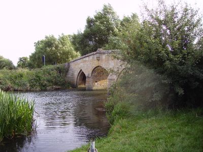
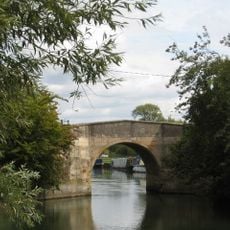
Radcot Bridge, Ponte stradale medievale a Great Faringdon, Inghilterra
Il Ponte di Radcot è una struttura in pietra che attraversa il Tamigi con tre sezioni distinte, caratterizzate da archi acuti costruiti in pietra di Taynton. La struttura sostiene il traffico veicolare sulla strada A4095 e rimane accessibile tutto l'anno.
La struttura è stata costruita intorno al 1200 e rimane il passaggio più antico del Tamigi. Ha avuto un ruolo nella Battaglia del Ponte di Radcot nel 1387 ed è stata protetta come monumento da allora.
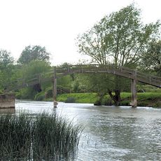
Il ponte collega le comunità e fa parte di percorsi escursionistici affermati lungo il fiume. I visitatori notano la struttura attentamente preservata che attraversa il corso d'acqua, servendo i viaggiatori nel corso dei secoli.
Il sito è aperto tutto l'anno e consente il traffico di veicoli, ma ha un limite di peso di 18 tonnellate. I visitatori devono fare attenzione al passaggio di veicoli pesanti e notare la struttura stretta.
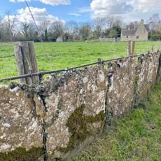
Gli scavi archeologici vicino al sito hanno rivelato i resti di un antico castello e strutture romane sotterranee. Questi ritrovamenti mostrano che l'area è stata abitata per secoli, molto prima della costruzione dell'attuale ponte.
La comunità dei viaggiatori curiosi
AroundUs riunisce migliaia di luoghi selezionati, consigli locali e gemme nascoste, arricchiti ogni giorno da oltre 60,000 contributori in tutto il mondo.