Faro di Berry Head, Faro costiero a Berry Head, Brixham, Regno Unito.
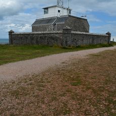
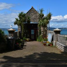
Berry Head Lighthouse è una piccola torre in pietra bianca situata su un promontorio calcareo della costa del Devon, nel sud-ovest dell'Inghilterra. La torre è alta solo 5 m, ma la scogliera su cui sorge porta la luce molto al di sopra del livello del mare.
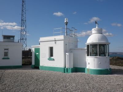
La torre fu costruita nel 1906 da Thomas Matthews per Trinity House, l'ente responsabile dei fari di Inghilterra e Galles. Funzionava originariamente a gas e fu poi convertita al sistema automatico tuttora in uso.
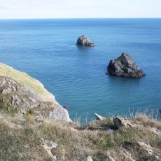
Il faro si trova all'interno di una riserva naturale dove i visitatori possono camminare lungo scogliere calcaree e accanto ad antichi terrapieni militari sullo stesso breve sentiero. La combinazione di costa e opere in pietra dà al promontorio un carattere stratificato, facile da leggere passeggiando.
Il faro si raggiunge a piedi attraverso la riserva naturale, con un parcheggio vicino all'ingresso del promontorio. Il sito è aperto e esposto al vento, quindi è consigliabile portare un indumento caldo anche in estate.
Con soli 5 m, questa è una delle torri faro più basse gestite da Trinity House in Inghilterra, ma la sua posizione sulla scogliera le conferisce una delle elevazioni luminose più alte dell'intera rete. La differenza tra l'altezza modesta della torre e l'elevazione reale della luce sul livello del mare è citata in guide di riferimento sui fari.
La comunità dei viaggiatori curiosi
AroundUs riunisce migliaia di luoghi selezionati, consigli locali e gemme nascoste, arricchiti ogni giorno da oltre 60,000 contributori in tutto il mondo.