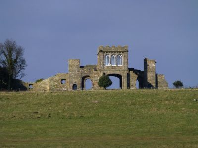
The Observatory, Osservatorio ornamentale a Longhoughton, Inghilterra
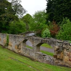
L'Osservatorio è una torre a pianta quadrata costruita in pietra grezza con dettagli in conci squadrati, poggiante su archi cavi smussati in cima alla scogliera. L'unica stanza interna contiene tre grandi finestre ad arco rotondo per parete, che inquadrano viste verso il castello di Alnwick e il Mare del Nord.
Robert Adam ha progettato questo edificio tra il 1754 e il 1770 per il primo duca di Northumberland, ed è ora classificato come Grade I. Fa parte dei miglioramenti architettonici che Adam ha creato in tutta la tenuta del duca durante quel periodo.
L'edificio faceva parte di una serie di punti d'osservazione che il primo duca di Northumberland fece costruire per godere del paesaggio circostante. Questi luoghi mostrano come i ricchi proprietari terrieri di allora potevano ammirare e controllare le loro proprietà.
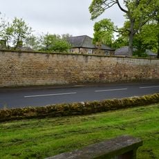
La posizione in cima alla scogliera offre viste aperte sui dintorni, ma raggiungerla richiede di camminare su terreno irregolare da Longhoughton. L'accesso all'interno della torre è limitato, poiché l'edificio si appezza principalmente dall'esterno.
La scogliera prende il nome da 'heugh', un termine locale del Northumberland per le colline ripide senza corsi d'acqua. Questo dettaglio linguistico rivela come i nomi dei luoghi preservano antiche distinzioni geografiche radicate nella lingua regionale.
La comunità dei viaggiatori curiosi
AroundUs riunisce migliaia di luoghi selezionati, consigli locali e gemme nascoste, arricchiti ogni giorno da oltre 60,000 contributori in tutto il mondo.