
A cairn and a rubble bank in Scale Knoll Allotment, 510m WSW of Haythwaite, Barningham Moor
A cairn and a rubble bank in Scale Knoll Allotment, 510m WSW of Haythwaite, Barningham Moor, archaeological site in Barningham, County Durham, England, UK
Posizione: Barningham
Coordinate GPS: 54.47510,-1.91999
Ultimo aggiornamento: 28 ottobre 2025 alle 06:14
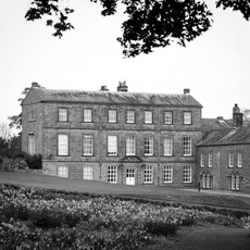
Barningham Park
3.6 km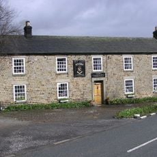
Milbank Arms
3.6 km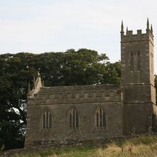
Church of St Mary
4 km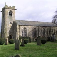
Church of St. Michael
3.6 km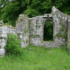
Ruins of Old Church of St Mary
4.1 km
Monument On Adam Hill, South East Of Barningham Park
3.8 km
Carved rock and Romano-British settlement known as Greystone, 250m south of Moorcock Farm, Barningham Moor
1.6 km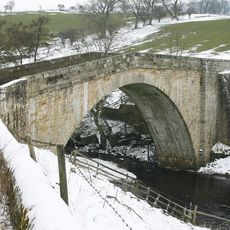
Rutherford Bridge
3.8 km
Cairn on the summit of Arndale Hill, Hope Moor
3.6 km
Cairn near the summit of a low ridge, 850m south west of Cocker Stake Nook, Hope Moor
2.8 km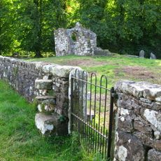
Churchyard Wall Around Old Church Of St Mary
4.1 km
Carved rock 380m ENE of Bragg House, Barningham Moor
2.5 km
A carved rock and boulder walling, near the south wall of Scale Knoll Allotment, 500m north east of Black Hill Gate
501 m
Carved rocks, cairnfield and rubble banks on the terrace south of Scale Knoll Allotment, immediately east of Black Hill Gate, Ba
674 m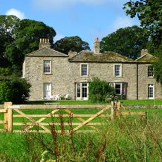
Brignall Grange
3.9 km
Cairn, 650m SSE of Bragg House, Barningham Moor
2.1 km
Prehistoric carved rocks and associated remains including cairns and a field system 800m south of Haythwaite, Barningham Moor
746 m
Carved rock and cairn in Rowley Intake, 410m south east of Cowclose House, Barningham Moor
1.5 km
Cairn south of Cross Gill, 645m south east of Black Hill Gate, Barningham Moor
1.2 km
Cairn, 625m SSE of Bragg House, Barningham Moor
2.1 km
Cairnfield and associated remains, 250m south east of Bragg House, Barningham Moor
2.4 km
A carved rock within a large enclosure, 800m north east of Badger Way Stoop, Barningham Moor
1.7 km
Cairn, 545m ESE of Bragg House, Barningham Moor
2.5 km
A carved rock between The Stang Forest boundary wall and Woodclose Gill, 750m south east of Far East Hope, Barningham Moor
780 m
Prehistoric settlement and associated remains including carved rocks and a stone circle 400m north west of How Tallon Cairn, Bar
1.2 km
Cairnfield on a small knoll at Badger Way Stoop, Barningham Moor
1.5 km
Carved rock north of Washbeck Green, 570m south of Haythwaite, Barningham Moor
639 m
Carved rock and prehistoric enclosure on west side of Scale Knoll Gill, 410m south west of Haythwaite, Barningham Moor
200 mRecensioni
Ha visitato questo luogo? Tocchi le stelle per valutarlo e condividere la Sua esperienza o foto con la community! Provalo ora! Puoi annullarlo in qualsiasi momento.
Scopri tesori nascosti ad ogni viaggio!
Da piccoli caffè caratteristici a panorami nascosti, fuggi dalla folla e scova i posti che fanno davvero per te. La nostra app ti semplifica tutto: ricerca vocale, filtri furbi, percorsi ottimizzati e dritte autentiche da viaggiatori di tutto il mondo. Scaricala subito per vivere l'avventura sul tuo smartphone!

Un nuovo approccio alla scoperta turistica❞
— Le Figaro
Tutti i luoghi che meritano di essere esplorati❞
— France Info
Un’escursione su misura in pochi clic❞
— 20 Minutes