
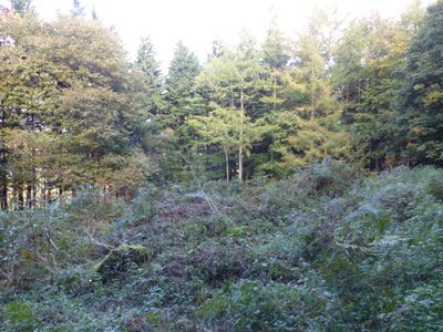
Roman period native settlement in Danefield Wood, 490m south west of Stubbings Farm
Roman period native settlement in Danefield Wood, 490m south west of Stubbings Farm, archaeological site in Otley, Leeds, England, UK
St Bartholomews Mission Church
1.4 km
Pair Of Cemetery Chapels At Otley Cemetery
1.6 km
The Junction Public House
1.7 km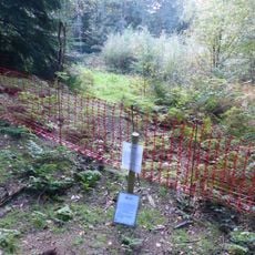
Roman period native settlement in Poolscar Wood, 350m south of Stubbings Farm
304 m
Manor House Public House
1.7 km
75, Bondgate
1.7 km
40, Bondgate
1.7 km
Bloomfield House
1.6 km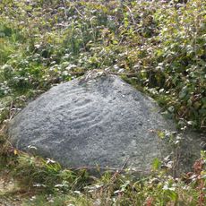
Cup and ring marked rock known as the Knotties Stone on Otley Chevin, 270m north east of The Royalty public house
1.2 km
21, Crow Lane
1.6 km
103 And 105, Cross Green
1.6 km
36, Cross Green
1.7 km
101, Cross Green
1.6 km
Caley House
1.7 km
63-69, Cross Green
1.6 km
71 And 73, Bondgate
1.7 km
Cross Green Youth Centre
1.6 km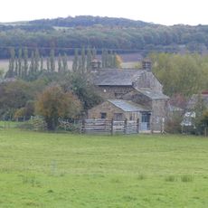
Midgeley House Farmhouse And Outbuildings
945 m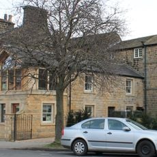
29, Cross Green
1.6 km
19, Crow Lane
1.6 km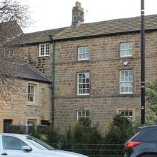
25, Cross Green
1.6 km
Man Hong Restaurant
1.7 km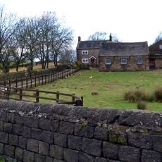
East Chevin Farmhouse And Outbuildings
597 m
14, Gay Lane
1.6 km
67 And 69, Bondgate
1.7 km
Anti-aircraft gunsite 280m east of Carlton Hall
1.4 km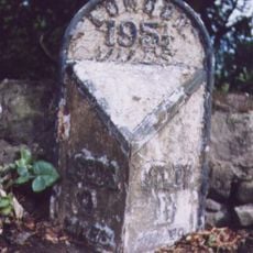
Milestone, Leeds Road, W of bend where Old Pool Bank Road joins at tollhouse
774 m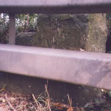
Milestone, East Chevin Road
529 mRecensioni
Ha visitato questo luogo? Tocchi le stelle per valutarlo e condividere la Sua esperienza o foto con la community! Provalo ora! Puoi annullarlo in qualsiasi momento.
Scopri tesori nascosti ad ogni viaggio!
Da piccoli caffè caratteristici a panorami nascosti, fuggi dalla folla e scova i posti che fanno davvero per te. La nostra app ti semplifica tutto: ricerca vocale, filtri furbi, percorsi ottimizzati e dritte autentiche da viaggiatori di tutto il mondo. Scaricala subito per vivere l'avventura sul tuo smartphone!

Un nuovo approccio alla scoperta turistica❞
— Le Figaro
Tutti i luoghi che meritano di essere esplorati❞
— France Info
Un’escursione su misura in pochi clic❞
— 20 Minutes