
St Donat's Churchyard Cross, churchyard cross in St Donats, Vale of Glamorgan, Wales
Posizione: St Donats
Altezza sopra il mare: 16,3 m
Coordinate GPS: 51.40140,-3.53428
Ultimo aggiornamento: 7 marzo 2025 alle 23:41
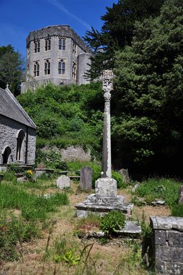
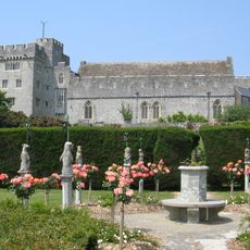
Castello di St Donat's
91 m
St Illtyd's Church, Llantwit Major
3.3 km
Dimlands
2.4 km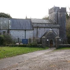
Church Of St Donat
23 m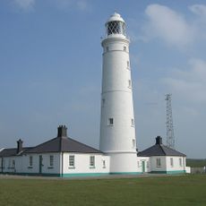
Nash Point Lighthouse
1.2 km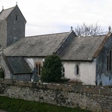
Church of the Holy Trinity
1.6 km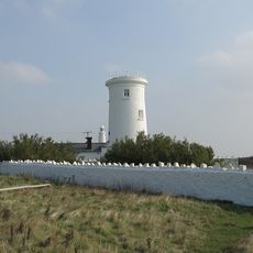
Old Nash Point Lighthouse
1.6 km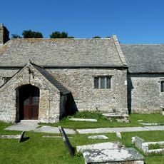
St Mary's Church
2.7 km
Nash Point Camp
1.9 km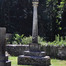
Nicholl-Carne Memorial Cross in Churchyard of Church of St Donat
34 m
The Old Police Station
3.3 km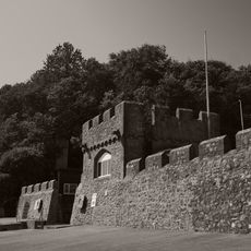
Sea Walls and Towers at St Donats Castle
314 m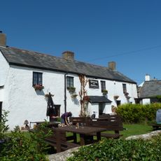
The Plough and Harrow
2.9 km
Old White Hart P.H.
3.4 km
West Farmhouse
3.3 km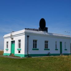
Fog Station at Nash Point Lighthouse
1.4 km
Plymouth House
3.3 km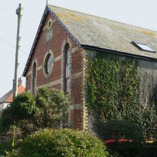
Ebenezer Calvinistic Methodist Chapel
3.2 km
Old Place (or Llantwit Major Castle)
3.4 km
Tabernacle Calvinistic Methodist Chapel
3.4 km
Cross in Churchyard of Church of St. Illtud
3.3 km
The Gatehouse (porter's Room)
3.2 km
Chantry House
3.3 km
The Old School, including attached walling
3.4 km
Footbridge over brook at West entrance to churchyard of Church of St Illtud
3.3 km
Llantwit Major Dovecote
3.2 km
Former Chantry Priest's House
3.3 km
Swimbridge Farmhouse with attached garden walls
3.3 kmRecensioni
Ha visitato questo luogo? Tocchi le stelle per valutarlo e condividere la Sua esperienza o foto con la community! Provalo ora! Puoi annullarlo in qualsiasi momento.
Scopri tesori nascosti ad ogni viaggio!
Da piccoli caffè caratteristici a panorami nascosti, fuggi dalla folla e scova i posti che fanno davvero per te. La nostra app ti semplifica tutto: ricerca vocale, filtri furbi, percorsi ottimizzati e dritte autentiche da viaggiatori di tutto il mondo. Scaricala subito per vivere l'avventura sul tuo smartphone!

Un nuovo approccio alla scoperta turistica❞
— Le Figaro
Tutti i luoghi che meritano di essere esplorati❞
— France Info
Un’escursione su misura in pochi clic❞
— 20 Minutes