Ashridge Commons and Woods

Accedi al tuo account

AroundUs è una mappa collaborativa di luoghi interessanti, costruita da esploratori curiosi come te. Cresce con ogni recensione, storia e foto che condividi.
Accedi per salvare i tuoi posti preferiti, contribuire con nuovi luoghi e creare percorsi personalizzati.
Continua con Google
Continua con Apple
Continua con X
Continua con Facebook
Continua con email
Continuando, accetti i nostri Termini e Condizioni e la nostra Informativa sulla Privacy
Creare un account
Aggiungi alla collezione
Mappa
Suggerisci una modifica
Condividere

Ashridge Commons and Woods, Area naturale protetta nell'Hertfordshire, Inghilterra

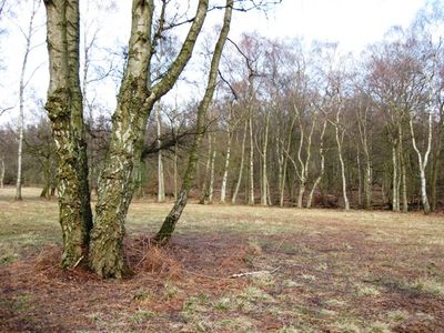
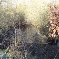
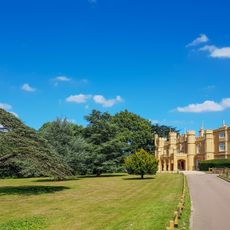
Ashridge Commons and Woods è un'area naturale protetta nelle Colline Chiltern caratterizzata da boschi estesi, prati e cespugli. Il sito ospita una diversità di habitat naturali su una superficie considerevole.

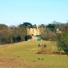
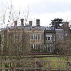
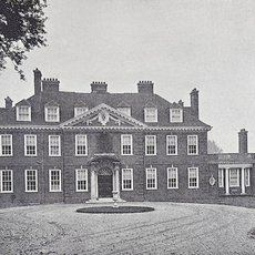
Il terreno faceva parte dell'Abbazia di Ashridge, fondata nel 1283, che in seguito divenne residenza reale per i figli del Re Enrico VIII. Dopo la soppressione del monastero, la proprietà si trasformò gradualmente nel paesaggio naturale attuale.

Il sito mantiene il suo status di area fondamentale per la ricerca ecologica, consentendo lo studio di rare specie di uccelli ed ecosistemi forestali.

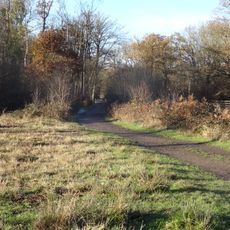
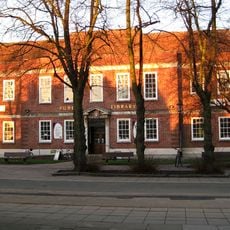
Il sito è accessibile da vari ingressi, incluso Moneybury Hill a Ringshall, dove percorsi segnati guidano i visitatori attraverso il paesaggio. Si consiglia calzature robuste poiché le condizioni del terreno variano.

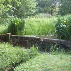
Diversi piccoli stagni nel bosco creano habitat specifici per anfibi e invertebrati. Questi specchi d'acqua contribuiscono considerevolmente alla diversità ecologica del sito.

Coordinate GPS: 51.69640,-0.36640

Ultimo aggiornamento: 14 dicembre 2025 alle 18:03

Foto
Intorno a questo luogo
Warner Bros. Studio Tour London - The Making of Harry Potter
Regno Unito

Warner Bros. Studio Tour London - The Making of Harry Potter

3.6 km
Bhaktivedanta Manor
Regno Unito

Bhaktivedanta Manor

4 km
Wall Hall
Regno Unito

Wall Hall

1.7 km
High Elms Manor
Regno Unito

High Elms Manor

2 km
Munden House
Regno Unito

Munden House

1 km
Hunton Park
Regno Unito

Hunton Park

4.1 km
Bricket Wood Common
Regno Unito

Bricket Wood Common

0 m
Regno Unito

Harebreaks Wood

3.4 km
Moor Mill Quarry, West
Regno Unito

Moor Mill Quarry, West

2 km
Stanborough Park Church
Regno Unito

Stanborough Park Church

2.3 km
Church of St John the Baptist
Regno Unito

Church of St John the Baptist

2.7 km
Church of the Ascension
Regno Unito

Church of the Ascension

4.3 km
Church of St Lawrence the Martyr
Regno Unito

Church of St Lawrence the Martyr

3.7 km
Church of the Holy Trinity
Regno Unito

Church of the Holy Trinity

3.2 km
Church of St Andrew
Regno Unito

Church of St Andrew

4.1 km
Wall Hall (The Mansion)
Regno Unito

Wall Hall (The Mansion)

1.7 km
Granary About 50 Metres South East Of Wall Hall Home Farm House
Regno Unito

Granary About 50 Metres South East Of Wall Hall Home Farm House

2 km
Replica of the Mohne Dam, in the grounds of the Building Research Establishment, Garston
Regno Unito

Replica of the Mohne Dam, in the grounds of the Building Research Establishment, Garston

820 m
Watford Central Library
Regno Unito

Watford Central Library

4.8 km
Bridge Number 163 50 Metres South West Of Grove Wharf
Regno Unito

Bridge Number 163 50 Metres South West Of Grove Wharf

4.8 km
Abbots Langley War Memorial About 40 Metres East North East Of Church Of St Lawerence
Regno Unito

Abbots Langley War Memorial About 40 Metres East North East Of Church Of St Lawerence

3.7 km
Benskin's House
Regno Unito

Benskin's House

4.2 km
London Coal Duty Marker On Verge Near Number 67
Regno Unito

London Coal Duty Marker On Verge Near Number 67

4.4 km
Watford Tunnel, South Entrance To West Tunnel
Regno Unito

Watford Tunnel, South Entrance To West Tunnel

3.9 km
London Coal Duty Boundary Marker At Tq 1164 9657
Regno Unito

London Coal Duty Boundary Marker At Tq 1164 9657

4.6 km
Mile Post On Towing Path Immediately South Of Bridge Carrying A 405 Over Canal
Regno Unito

Mile Post On Towing Path Immediately South Of Bridge Carrying A 405 Over Canal

4.8 km
Five Arches, Railway Viaduct 200 Metres North of Water Lane
Regno Unito

Five Arches, Railway Viaduct 200 Metres North of Water Lane

4.6 km
Milestone, Watling Street, 30m S of Station Road
Regno Unito

Milestone, Watling Street, 30m S of Station Road

3.5 km
Mostra la mappa completa
Recensioni

Ha visitato questo luogo? Tocchi le stelle per valutarlo e condividere la Sua esperienza o foto con la community! Provalo ora! Puoi annullarlo in qualsiasi momento.

« Ashridge Commons and Woods - Area naturale protetta nell'Hertfordshire, Inghilterra » è fornito da Around Us (it.aroundus.com). Le immagini e i testi sono tratti dal progetto Wikimedia con licenza Creative Commons. È possibile copiare, distribuire e modificare copie di questa pagina, alle condizioni stabilite dalla licenza, a condizione che questa nota sia chiaramente visibile.

Scopri tesori nascosti ad ogni viaggio!

Da piccoli caffè caratteristici a panorami nascosti, fuggi dalla folla e scova i posti che fanno davvero per te. La nostra app ti semplifica tutto: ricerca vocale, filtri furbi, percorsi ottimizzati e dritte autentiche da viaggiatori di tutto il mondo. Scaricala subito per vivere l'avventura sul tuo smartphone!

Around Us App Screenshot

Un nuovo approccio alla scoperta turistica

Le Figaro

Tutti i luoghi che meritano di essere esplorati

France Info

Un’escursione su misura in pochi clic

20 Minutes