Higham Dykes, building in Ponteland, Northumberland, UK
Posizione: Ponteland
Coordinate GPS: 55.07185,-1.79216
Ultimo aggiornamento: 3 novembre 2025 alle 12:16
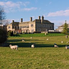
Kirkley Hall
2.5 km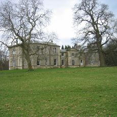
Milbourne Hall
2.3 km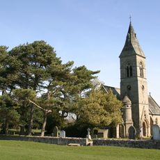
Church of Holy Saviour
1.7 km
Restaurant To Rear Of The Highlander Public House
1.8 km
Benridge Hall Cottage
1.9 km
South Lodge And Gatepiers
2.2 km
High House Farm Cottage
2.5 km
Pigsty Approximately 20 Yards North Of Milbourne Hall
2.3 km
Benridge Hall
1.7 km
Block 27
2.4 km
Gateway Approximately 440 Yards East Of Benridge Hall
2.1 km
Blocks 9-10 And 11-12
2.4 km
Obelisk Approximately 440 Yards South-West Of Kirkley Hall
2.1 km
High House Farmhouse
2.4 km
Wall Railings And Gate, East Of Church Of Holy Saviour
1.6 km
Blocks 1-2 And 3-4
2.4 km
Block 13
2.5 km
Higham Dykes Farmhouse And Attached Shelter Sheds
89 m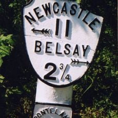
Milepost, Milbourne, just N of "Waggon Inn" PH
795 m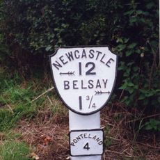
Milepost, Ogle, nr Nunhill Farm, N of The Highlander Inn
2.3 km
Stables And Carriage House Attached To North-West Of Higham Dykes
26 m
Sundial Approximately 30 Yards South Of Higham Dykes
44 m
Blocks 5-6 And 7-8
2.4 km
Coach House Approximately 30 Yards North-East Of Benridge Hall
1.7 km
The Highlander Public House
1.8 km
Summer House And Garden Wall West And South Of Higham Dykes
62 m
The Farmhouse
2 km
Westgate
707 mRecensioni
Ha visitato questo luogo? Tocchi le stelle per valutarlo e condividere la Sua esperienza o foto con la community! Provalo ora! Puoi annullarlo in qualsiasi momento.
Scopri tesori nascosti ad ogni viaggio!
Da piccoli caffè caratteristici a panorami nascosti, fuggi dalla folla e scova i posti che fanno davvero per te. La nostra app ti semplifica tutto: ricerca vocale, filtri furbi, percorsi ottimizzati e dritte autentiche da viaggiatori di tutto il mondo. Scaricala subito per vivere l'avventura sul tuo smartphone!

Un nuovo approccio alla scoperta turistica❞
— Le Figaro
Tutti i luoghi che meritano di essere esplorati❞
— France Info
Un’escursione su misura in pochi clic❞
— 20 Minutes