Baugh Fell

Accedi al tuo account

AroundUs è una mappa collaborativa di luoghi interessanti, costruita da esploratori curiosi come te. Cresce con ogni recensione, storia e foto che condividi.
Accedi per salvare i tuoi posti preferiti, contribuire con nuovi luoghi e creare percorsi personalizzati.
Continua con Google
Continua con Apple
Continua con X
Continua con Facebook
Continua con email
Continuando, accetti i nostri Termini e Condizioni e la nostra Informativa sulla Privacy
Creare un account

Baugh Fell

Aggiungi alla collezione
Mappa
Suggerisci una modifica
Condividere

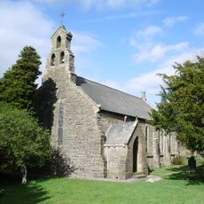
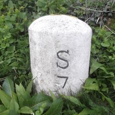
Baugh Fell, Collina a Garsdale, Inghilterra.

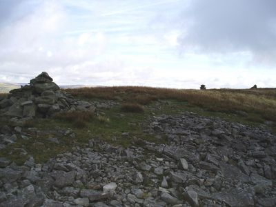
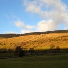
Baugh Fell è una collina nel Garsdale con un ampio altipiano sommitale a forma di L. I pendii sono formati da arenaria e calcare, con il punto più alto a 678 metri.

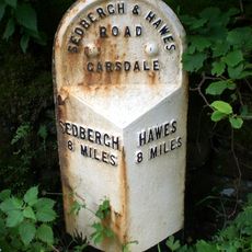
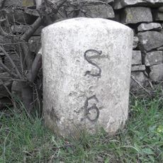
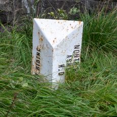
Questa collina fece parte del West Riding of Yorkshire fino ai cambiamenti amministrativi del 1974 che la trasferirono in Cumbria. L'aggiustamento dei confini rifletteva riorganizzazioni più ampie del governo locale nell'Inghilterra settentrionale.

La collina ospita sei piccoli laghi, con cinque East Tarns nella sezione orientale e un West Tarn nascosto in una depressione a nord-ovest.

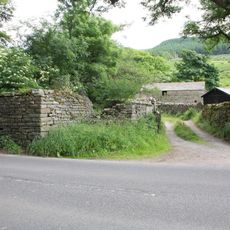
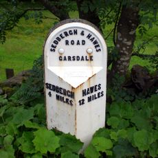
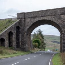
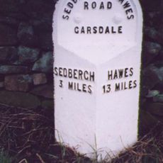
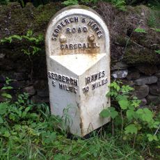
I camminatori possono iniziare dal parcheggio di Tom Croft Hill lungo la strada A684 e devono prepararsi per un'escursione impegnativa. Il percorso è lungo e esposto, quindi si consiglia abbigliamento robusto e impermeabile.

Diversi piccoli laghi costellano l'altipiano sommitale, compresi gli East Tarns sparsi sul fianco orientale e la nascosta West Tarn in una depressione verso nord-ovest. Questi specchi d'acqua creano punti di interesse naturale nel paesaggio di roccia nuda e brughiera.

Posizione: Garsdale

Altezza sopra il mare: 678 m

Coordinate GPS: 54.31977,-2.40044

Ultimo aggiornamento: 14 dicembre 2025 alle 13:20

Foto
Intorno a questo luogo
Dandrymire Viaduct
Regno Unito

Dandrymire Viaduct

5.3 km
St John the Evangelist's Church, Cowgill
Regno Unito

St John the Evangelist's Church, Cowgill

5 km
Uldale Force
Regno Unito

Uldale Force

4.1 km
Church of St John the Baptist
Regno Unito

Church of St John the Baptist

2.2 km
Church of St Mark
Regno Unito

Church of St Mark

5.7 km
Wesleyan Methodist Church
Regno Unito

Wesleyan Methodist Church

5.7 km
Ewegales Bridge
Regno Unito

Ewegales Bridge

5 km
Dandra Garth
Regno Unito

Dandra Garth

2.3 km
Garsdale Milestone Immediately East Of Boundary Marker
Regno Unito

Garsdale Milestone Immediately East Of Boundary Marker

5.4 km
Passenger Waiting Room On East Side Of Railway Track At Dent Station
Regno Unito

Passenger Waiting Room On East Side Of Railway Track At Dent Station

4.8 km
East Rackenthwaite And Adjoining Barn
Regno Unito

East Rackenthwaite And Adjoining Barn

1.6 km
Gibbs Hall
Regno Unito

Gibbs Hall

5.3 km
Milestone (Sedbergh 8) Approximately 200 Metres East Of Broadfield Lane On South Side Of Road
Regno Unito

Milestone (Sedbergh 8) Approximately 200 Metres East Of Broadfield Lane On South Side Of Road

5.2 km
Milestone (Sedbergh 4) Approximately 20 Metres West Of Bellow Hill Turn
Regno Unito

Milestone (Sedbergh 4) Approximately 20 Metres West Of Bellow Hill Turn

2.5 km
High Hall Farmhouse Including Cartshed
Regno Unito

High Hall Farmhouse Including Cartshed

5.5 km
Milestone (Sedbergh 7) Approximately 170 Metres West Of Sundial Cottage
Regno Unito

Milestone (Sedbergh 7) Approximately 170 Metres West Of Sundial Cottage

5.3 km
Garsdale Signal Box
Regno Unito

Garsdale Signal Box

4.8 km
Milestone (Sedbergh 8) Approximately 5 Metres East Of Scar Foot Bridge
Regno Unito

Milestone (Sedbergh 8) Approximately 5 Metres East Of Scar Foot Bridge

3.3 km
Moorcock Road railway bridge
Regno Unito

Moorcock Road railway bridge

5.4 km
Milestone (Sedbergh 3) To East Of Steps End
Regno Unito

Milestone (Sedbergh 3) To East Of Steps End

5.8 km
Milestone (Sedbergh 9) Approximately 250 Metres East Of Harding Bridge (Not Included)
Regno Unito

Milestone (Sedbergh 9) Approximately 250 Metres East Of Harding Bridge (Not Included)

4.3 km
Milestone approximately 100 metres east of Low Branthwaites on Hawes Road
Regno Unito

Milestone approximately 100 metres east of Low Branthwaites on Hawes Road

5.4 km
Milestone (Sedbergh 9) On South Side Of Road Approximately 50 Metres South West Of Cowgill Bridge
Regno Unito

Milestone (Sedbergh 9) On South Side Of Road Approximately 50 Metres South West Of Cowgill Bridge

5 km
Milestone (Sedbergh 6) Approximately 5 Metres West Of Hallbank Lane
Regno Unito

Milestone (Sedbergh 6) Approximately 5 Metres West Of Hallbank Lane

5.3 km
Milestone (Sedbergh 3) Approximately 10 Metres East Of Nether House (Not Included)
Regno Unito

Milestone (Sedbergh 3) Approximately 10 Metres East Of Nether House (Not Included)

3.9 km
Garsdale Boundary Marker At Country Boundary Of North Yorkshire And Cumbria
Regno Unito

Garsdale Boundary Marker At Country Boundary Of North Yorkshire And Cumbria

5.4 km
Milestone (Sedbergh 6) Approximately 75 Metres West Of Kirk Bridge
Regno Unito

Milestone (Sedbergh 6) Approximately 75 Metres West Of Kirk Bridge

2.1 km
Milestone (Sedbergh 7) Approximately 10 Metres West Of East Little Town
Regno Unito

Milestone (Sedbergh 7) Approximately 10 Metres West Of East Little Town

2.5 km
Mostra la mappa completa
Recensioni

Ha visitato questo luogo? Tocchi le stelle per valutarlo e condividere la Sua esperienza o foto con la community! Provalo ora! Puoi annullarlo in qualsiasi momento.

« Baugh Fell - Collina a Garsdale, Inghilterra » è fornito da Around Us (it.aroundus.com). Le immagini e i testi sono tratti dal progetto Wikimedia con licenza Creative Commons. È possibile copiare, distribuire e modificare copie di questa pagina, alle condizioni stabilite dalla licenza, a condizione che questa nota sia chiaramente visibile.

Scopri tesori nascosti ad ogni viaggio!

Da piccoli caffè caratteristici a panorami nascosti, fuggi dalla folla e scova i posti che fanno davvero per te. La nostra app ti semplifica tutto: ricerca vocale, filtri furbi, percorsi ottimizzati e dritte autentiche da viaggiatori di tutto il mondo. Scaricala subito per vivere l'avventura sul tuo smartphone!

Around Us App Screenshot

Un nuovo approccio alla scoperta turistica

Le Figaro

Tutti i luoghi che meritano di essere esplorati

France Info

Un’escursione su misura in pochi clic

20 Minutes