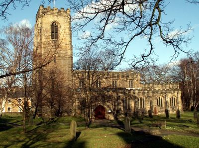
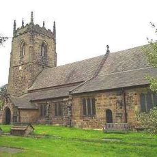
Church of All Saints, Chiesa parrocchiale a Darton, Inghilterra
La Chiesa di Tutti i Santi e una chiesa parrocchiale in pietra a Darton con un tetto a capriate dorato nella navata. L'interno espone vetrate vittoriane e conserva originali chiavi di volta in tutta la struttura.
La costruzione della chiesa inizio nel 1480 sul sito di due strutture precedenti risalenti al 1160. L'edificio attuale fu completato nel 1517.
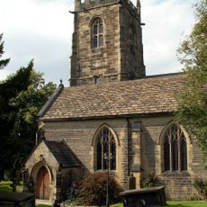
L'interno contiene carving medievali in pietra, inclusi dettagli decorativi sugli stalli del coro e quattro figure di Uomini Verdi. Questi dettagli realizzati a mano rivelano l'abilita degli artigiani che hanno lavorato sull'edificio.
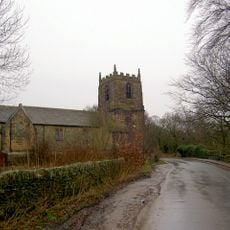
L'accesso all'edificio e limitato a determinati orari, quindi i visitatori devono verificare gli orari di apertura prima di pianificare una visita. La chiesa si trova centralmente nel villaggio con parcheggio disponibile nelle vicinanze per comodita.
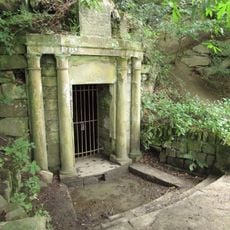
Un altare in pietra dell'11o secolo fu scoperto nel 1924 dopo essere stato nascosto durante la Riforma. L'altare rimane nella sua posizione originale dentro l'edificio oggi.
La comunità dei viaggiatori curiosi
AroundUs riunisce migliaia di luoghi selezionati, consigli locali e gemme nascoste, arricchiti ogni giorno da oltre 60,000 contributori in tutto il mondo.