
Settlement at Bean Hay Copse, archaeological site in Down Ampney, Cotswold, England, UK
Posizione: Down Ampney
Coordinate GPS: 51.66400,-1.85254
Ultimo aggiornamento: 25 novembre 2023 alle 00:50
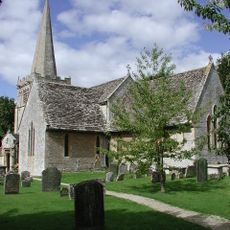
Church of All Saints
607 m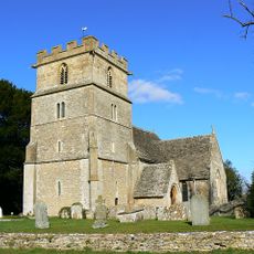
Church of St John The Baptist, Latton With Eisey
1 km
Pair Of Habgood Monuments In Churchyard, 8 Metres South Of Chancel, Church Of St John
1 km
Pair Of Habgood Monuments In Churchyard, 10-12 Metres South Of Chancel, Church Of St John
1 km
Pair Of Habgood Monuments In Churchyard, 4 To 6 Metres South Of South Trancept, Church Of St John
1 km
Group Of 19 Monuments, About 3 To 23 Metres South Of South Transept And Aisle In Churchyard Of Church Of All Saints
594 m
Unidentified Monument In Churchyard, 5 Metres South West Of Tower, Church Of St John
1 km
Unidentified Monument, In Churchyard 9 Metres South Of Porch, Church Of St John
1 km
Lane Monument In Churchyard, 4 Metres South Of Chancel, Church Of St John
1 km
Pepwell And Associated Monument In Churchyard, 17 Metres South West Of Tower, Church Of St John
1 km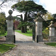
Down Ampney House
682 m
Gingell And 4 Unidentified Monuments, About 1 Metre From South East Corner Of Chancel In Churchyard Of Church Of All Saints
594 m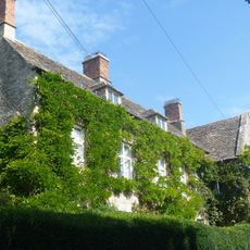
St Mary's
994 m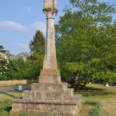
Village cross
1 km
16 And 17, Down Ampney Village
1.1 km
Latton House
943 m
51 And 52, Down Ampney Village
1.1 km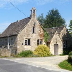
Village School
1.1 km
Thirteen Monuments, Including Kimber And Green, About 5 To 15 Metres South East Of South East Corner Of South Transept In Churchyard Of Church Of All Saints
588 m
Green Monument In Churchyard, 22 Metres South Of South Porch, Church Of St John
1 km
Three Pinniger Monuments, About 4 To 12 Metres North East Of North East Chancel Corner In Churchyard Of Church Of All Saints
606 m
Cook Monument In Churchyard, 10 Metres South West Of Tower, Church Of St John
1 km
Gatepiers At Down Ampney House
603 m
Two Parker Monuments, About 12 Metres East Of East Window In Churchyard Of Church Of All Saints
588 m
Home Farmhouse
702 m
42 And 43, Down Ampney Village
1.1 km
The Glebe Cottage
1.1 km
Down Ampney Church Of England Controlled School
1.1 kmRecensioni
Ha visitato questo luogo? Tocchi le stelle per valutarlo e condividere la Sua esperienza o foto con la community! Provalo ora! Puoi annullarlo in qualsiasi momento.
Scopri tesori nascosti ad ogni viaggio!
Da piccoli caffè caratteristici a panorami nascosti, fuggi dalla folla e scova i posti che fanno davvero per te. La nostra app ti semplifica tutto: ricerca vocale, filtri furbi, percorsi ottimizzati e dritte autentiche da viaggiatori di tutto il mondo. Scaricala subito per vivere l'avventura sul tuo smartphone!

Un nuovo approccio alla scoperta turistica❞
— Le Figaro
Tutti i luoghi che meritano di essere esplorati❞
— France Info
Un’escursione su misura in pochi clic❞
— 20 Minutes