
Shrunken medieval village at Sadberge, archaeological site in Sadberge, Darlington, England, UK
Posizione: Sadberge
Coordinate GPS: 54.54853,-1.47165
Ultimo aggiornamento: 25 novembre 2023 alle 00:50

Church of St Andrew
396 m
4 And 5, Chapel Row
149 m
Cottage And Smithy To Left Of Number 9
2.6 km
Thorn Cottage
317 m
Sadberge Castle
403 m
Milepost Between Numbers 8 And 9
1.1 km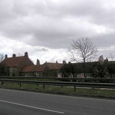
Little Burdon Farmhouse
1.6 km
White House
99 m
Barn On Left Rear Of Close Farmhouse
2.6 km
Burdon House
2.5 km
Sadberge Hall
1.5 km
Thithe House
289 m
Barmpton Hall
2.8 km
Lych Gate and Churchyard Wall of Church of St Andrew
408 m
Longpasture House With Barn On Left Return
2.5 km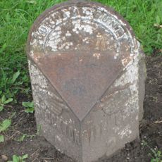
Milepost And Milestone 15 Metres West Of Number 2
2.6 km
Raby House
160 m
Great Burdon Farmhouse
2.5 km
Water Mill On Left Return Of Mill Batts Farmhouse
2.6 km
(Bewick) Outbuilding To South West Of No 76
3.3 km
Ivy Cottage
2.5 km
The Three Tuns Public House
195 m
Cargott Farm Threshing Barn 20 Metres East Of Glendor
2.5 km
Close Farmhouse
2.6 km
Farmbuildings On Left Of Great Burdon Farmhouse
2.5 km
World War II bombing decoy control shelter 600m south east of Great Burdon Farm
2.1 km
Little Burdon Cottage
1.6 km
Lyric Cinema
3.2 kmRecensioni
Ha visitato questo luogo? Tocchi le stelle per valutarlo e condividere la Sua esperienza o foto con la community! Provalo ora! Puoi annullarlo in qualsiasi momento.
Scopri tesori nascosti ad ogni viaggio!
Da piccoli caffè caratteristici a panorami nascosti, fuggi dalla folla e scova i posti che fanno davvero per te. La nostra app ti semplifica tutto: ricerca vocale, filtri furbi, percorsi ottimizzati e dritte autentiche da viaggiatori di tutto il mondo. Scaricala subito per vivere l'avventura sul tuo smartphone!

Un nuovo approccio alla scoperta turistica❞
— Le Figaro
Tutti i luoghi che meritano di essere esplorati❞
— France Info
Un’escursione su misura in pochi clic❞
— 20 Minutes