
Group of salterns and a possible moat 250m east of Bramber Castle
Group of salterns and a possible moat 250m east of Bramber Castle, archaeological site in Bramber, Horsham, England, UK
Posizione: Bramber
Coordinate GPS: 50.88420,-0.31262
Ultimo aggiornamento: 19 novembre 2025 alle 22:40
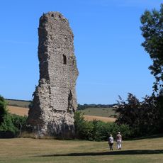
Castello di Bramber
245 m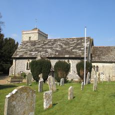
The Parish Church of St Peter
611 m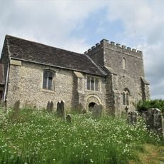
The Parish Church of St Nicholas
238 m
Beam Ends Hope Cottage
487 m
The Kings Head Inn
564 m
The Bridge Inn
470 m
Kings Barn Old Cottages
712 m
The Old Priory
169 m
Yew Tree Cottage
149 m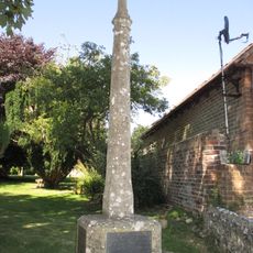
Upper Beeding War Memorial
590 m
1725 Cottages (Antiques)
718 m
The Priory
621 m
Burletts
587 m
Old Tiled Cottage Starlings
669 m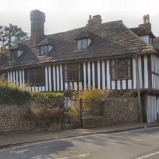
St Mary's House
209 m
The Garden Wall Of Pond Farmhouse To The East Of The House
647 m
Saltern in Saltings Field, 220m north of Beeding Bridge
415 m
Manor Cottage
557 m
Ferndale Glendale
527 m
Barn Belonging To The King's Head Inn To The West Of Pond Farmhouse
586 m
The Dilly
673 m
Cherry Tree Cottage Tall Chimneys
701 m
Maudlin Farm Cottage
599 m
The Manor House The Manor House Pharmacy
548 m
Holly Cottage
716 m
Candytuft
690 m
F H Lucas And Son Grocer Spinners
504 m
Pond Farmhouse
622 mRecensioni
Ha visitato questo luogo? Tocchi le stelle per valutarlo e condividere la Sua esperienza o foto con la community! Provalo ora! Puoi annullarlo in qualsiasi momento.
Scopri tesori nascosti ad ogni viaggio!
Da piccoli caffè caratteristici a panorami nascosti, fuggi dalla folla e scova i posti che fanno davvero per te. La nostra app ti semplifica tutto: ricerca vocale, filtri furbi, percorsi ottimizzati e dritte autentiche da viaggiatori di tutto il mondo. Scaricala subito per vivere l'avventura sul tuo smartphone!

Un nuovo approccio alla scoperta turistica❞
— Le Figaro
Tutti i luoghi che meritano di essere esplorati❞
— France Info
Un’escursione su misura in pochi clic❞
— 20 Minutes