
The Raswell, architectural structure in Hascombe, Waverley, Surrey, UK
Posizione: Hascombe
Coordinate GPS: 51.13601,-0.57312
Ultimo aggiornamento: 20 novembre 2025 alle 16:14
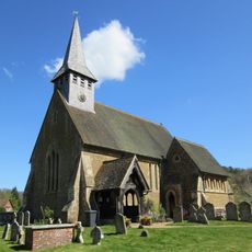
Church of St Peter
1.2 km
Hascombe Camp: a small multivallate hillfort north west of Lodge Farm
620 m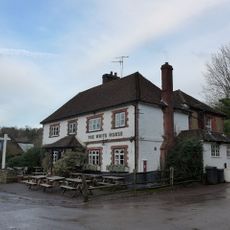
The White Horse Public House
1.1 km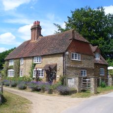
Lower House
1.5 km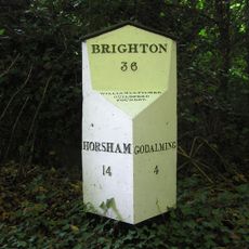
Milepost, Godalming Road, by Deer Park Cottage
262 m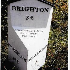
Milepost, Park Hatch, Dunsfold Road, opp. jct with Dunsfold Common Road
1.5 km
Lodge Farm House
744 m
Long Vere House
460 m
Hoe Farm House
1.2 km
Chest Tomb 3 Metres North Of The Church Of St Peter
1.2 km
Chest Tomb 5 Metres North West Of Church Of St Peter
1.2 km
Tomb 6 Metres North West Of Church Of St Peter
1.2 km
Granary 5 Metres North East Of Lodge Farm House
774 m
Hascombe Place
1.2 km
Chest Tomb 1 Metre From North West Buttress Of Church Of St Peter
1.2 km
Fountain Fountain At Junction With Hoe Road
1.5 km
Pound Cottages
905 m
Matthews Place
1.5 km
Sussex Lodges, Park Hatch And Walls
770 m
The Pound
925 m
The Old Rectory
719 m
Chest Tomb 1 Metre North Of Church Of St Peter
1.2 km
Chest Tomb 4 Metres North Of North West Buttress Of Church Of St Peter
1.2 km
Tomb 7 Metres North West Of The Church Of St Peter
1.2 km
Church Cottage Nuthurst
1.1 km
Pear Tree Cottage
1.2 km
Markwick Farm House
514 m
Burgate House
1.1 kmRecensioni
Ha visitato questo luogo? Tocchi le stelle per valutarlo e condividere la Sua esperienza o foto con la community! Provalo ora! Puoi annullarlo in qualsiasi momento.
Scopri tesori nascosti ad ogni viaggio!
Da piccoli caffè caratteristici a panorami nascosti, fuggi dalla folla e scova i posti che fanno davvero per te. La nostra app ti semplifica tutto: ricerca vocale, filtri furbi, percorsi ottimizzati e dritte autentiche da viaggiatori di tutto il mondo. Scaricala subito per vivere l'avventura sul tuo smartphone!

Un nuovo approccio alla scoperta turistica❞
— Le Figaro
Tutti i luoghi che meritano di essere esplorati❞
— France Info
Un’escursione su misura in pochi clic❞
— 20 Minutes