Mansers, building in Hildenborough, Tonbridge and Malling, Kent, UK
Posizione: Hildenborough
Coordinate GPS: 51.22395,0.21444
Ultimo aggiornamento: 20 novembre 2025 alle 19:45

Iron's Lane Cottage
629 m
Nizels Farm Cottage
602 m
Nizels Cottage
933 m
Stables About 45 Metres West Of Limes Farmhouse
1.1 km
Old House
896 m
The Lodge, Nizels
884 m
Gate Piers, Gate And Flanking Walls To The Drive To Nizels House
858 m
Outbuilding Immediately North East Of Old Farmhouse
706 m
Durhams Farmhouse
659 m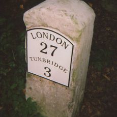
Milestone At 552 502
742 m
Nizels Hoath
878 m
Yew Tree Cottage
694 m
The Cottage
815 m
Keepers Cottage
569 m
Gatepiers, Gates, Garden Walls And Pool North West And West Of Nizels House
845 m
Old House Farmhouse
731 m
Tips Cross Cottage
1 km
Barn Immediately West Of Old House
880 m
Muddle Cottage
727 m
Pool South East Of Nizels House, Between The Buddha And Sunken Gardens
799 m
Walls And Steps To The Buddha Garden Immediately East Of Nizel's House
492 m
Walls, Steps And Statue To The Sunken Garden South East Of Nizels House
778 m
Mansers Farmhouse
69 m
Philpots
633 m
Francis Cottages
876 m
Nizels House
813 m
Pond Cottage
740 m
Nizels
952 mRecensioni
Ha visitato questo luogo? Tocchi le stelle per valutarlo e condividere la Sua esperienza o foto con la community! Provalo ora! Puoi annullarlo in qualsiasi momento.
Scopri tesori nascosti ad ogni viaggio!
Da piccoli caffè caratteristici a panorami nascosti, fuggi dalla folla e scova i posti che fanno davvero per te. La nostra app ti semplifica tutto: ricerca vocale, filtri furbi, percorsi ottimizzati e dritte autentiche da viaggiatori di tutto il mondo. Scaricala subito per vivere l'avventura sul tuo smartphone!

Un nuovo approccio alla scoperta turistica❞
— Le Figaro
Tutti i luoghi che meritano di essere esplorati❞
— France Info
Un’escursione su misura in pochi clic❞
— 20 Minutes