Broughton, building in Kemsing, Sevenoaks, Kent, UK
Posizione: Kemsing
Coordinate GPS: 51.30319,0.25218
Ultimo aggiornamento: 13 novembre 2025 alle 03:09
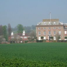
St Clere
927 m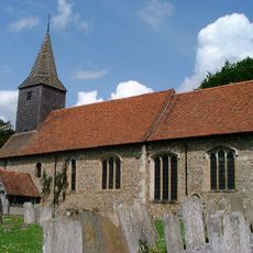
Church of St Mary
1.5 km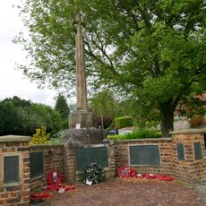
Kemsing War Memorial
1.6 km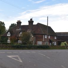
Walnut Tree Cottage
358 m
Noah's Ark
1.4 km
Stonepitts Manor House
1.4 km
Crowdleham
588 m
Glen Cottage Gwen's Cottage
1.5 km
Rose Cottage The Well Cottage
1.6 km
Outbuilding To North East Of St Clere
965 m
Outbuilding To North West Of St Clere
929 m
The Chequers Public House
273 m
Pillar Box House
379 m
Oast Building To East Of Pillar Box House
380 m
The St Edith's Hall
1.5 km
The Keep
1.6 km
Forecourt Wall To The St Edith's Hall
1.5 km
The Vicarage
1.5 km
Stones Stores, Foster House
1.6 km
Wybourne Cottages
1.5 km
Yew Tree House
1.6 km
Garden Walls Surrounding Stonepitts Manor House
1.4 km
The Kemsing Heritage Centre
1.6 km
Forecourt Wall And Gates To North Of St Clere
965 m
Lower St Clere
689 m
Ivy Cottage
199 m
The Malt House
885 m
Wall In Front Of West Part Of Garden Of The Vicarage
1.5 kmRecensioni
Ha visitato questo luogo? Tocchi le stelle per valutarlo e condividere la Sua esperienza o foto con la community! Provalo ora! Puoi annullarlo in qualsiasi momento.
Scopri tesori nascosti ad ogni viaggio!
Da piccoli caffè caratteristici a panorami nascosti, fuggi dalla folla e scova i posti che fanno davvero per te. La nostra app ti semplifica tutto: ricerca vocale, filtri furbi, percorsi ottimizzati e dritte autentiche da viaggiatori di tutto il mondo. Scaricala subito per vivere l'avventura sul tuo smartphone!

Un nuovo approccio alla scoperta turistica❞
— Le Figaro
Tutti i luoghi che meritano di essere esplorati❞
— France Info
Un’escursione su misura in pochi clic❞
— 20 Minutes