55, building in Duncton, Chichester, West Sussex, UK
Posizione: Duncton
Coordinate GPS: 50.94539,-0.63524
Ultimo aggiornamento: 25 novembre 2023 alle 01:30
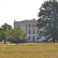
Burton Park
925 m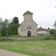
St Richard's Church
910 m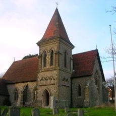
Church of Holy Trinity, Duncton
431 m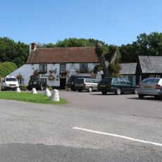
The Cricketers Inn
113 m
Romano-British settlement at Church Farm
546 m
The Former Stable At Duncton Mill To The South Of The Mill Building
687 m
South Corner
598 m
63 And 64, High Street
625 m
Barn At Manor Farm To The North West Of The Manor House
485 m
Manor Farmhouse
541 m
Old Schoolhouse Cottages
459 m
60, High Street
565 m
Duncton House
576 m
Gate Piers And Flanking Walls At The Entrance To Lavington Park
333 m
Duncton Cottage
603 m
Duncton Mill, The Mill House
620 m
The Former Cart Shed And Granary At Duncton Mill To The North East Of The Mill House
623 m
The East Lodges And Gateway Of Lavington Park Situated To South West Of Gate Piers And Flanling Walls
482 m
Barn At Duncton Mill To The North East Of The Former Cart Shed And Granary
631 m
The Manor House
641 m
The Old Post House
649 m
Duncton Mill, The Mill Building
663 m
Church of St Anthony and St George
672 m
Outbuilding Adjoining Letterbox Cottage On The South East
163 m
Haymarsh
812 m
Ridlington Farmhouse
848 m
Letterbox Cottage
153 m
The Gateway To The West Or Main Drive Of Burton Park (St Michael's School)
135 mRecensioni
Ha visitato questo luogo? Tocchi le stelle per valutarlo e condividere la Sua esperienza o foto con la community! Provalo ora! Puoi annullarlo in qualsiasi momento.
Scopri tesori nascosti ad ogni viaggio!
Da piccoli caffè caratteristici a panorami nascosti, fuggi dalla folla e scova i posti che fanno davvero per te. La nostra app ti semplifica tutto: ricerca vocale, filtri furbi, percorsi ottimizzati e dritte autentiche da viaggiatori di tutto il mondo. Scaricala subito per vivere l'avventura sul tuo smartphone!

Un nuovo approccio alla scoperta turistica❞
— Le Figaro
Tutti i luoghi che meritano di essere esplorati❞
— France Info
Un’escursione su misura in pochi clic❞
— 20 Minutes