
Lower Clayhill, architectural structure in Ringmer, Lewes, East Sussex, UK
Posizione: Ringmer
Coordinate GPS: 50.91178,0.05298
Ultimo aggiornamento: 20 novembre 2025 alle 14:50
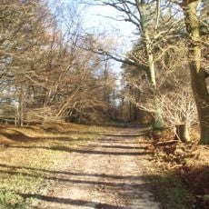
Plashett Park Wood
2 km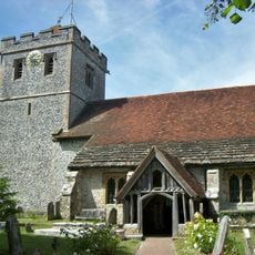
The Parish Church of St Mary the Virgin
2 km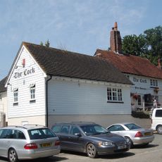
The Cock Inn
962 m
Barn To South West Of Half Yard Farmhouse
2 km
Hayes Farmhouse
1.4 km
Medieval ringwork at Clay Hill
513 m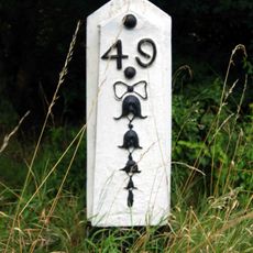
Milepost, Uckfield Road, Upper Wellingham
1.9 km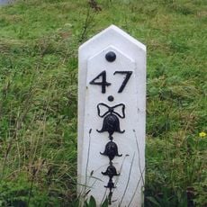
Milepost, jct with Isfield Road, N of the Old Ship PH
1.2 km
The Garden Wall And Gate Piers Of Wellingham House To The East Of The House
1.8 km
Park Gate And Attached Wall To The North West And South East
1.7 km
The Gazebo At Wellingham House To The South West Of The House
1.9 km
Barn At Upper Clayhill Farm To The West Of The House
495 m
Holly Tree Cottage
1.3 km
Upper Clayhill Farmhouse
490 m
Wellingham House
1.8 km
South Norlington House
1.8 km
Cheyney Charity Almshouses
2 km
Wellingham Cottages
1.3 km
Lilac Cottage
1.2 km
The Old Ship Inn
1.1 km
Wellingham Farmhouse
1.8 km
Norlington Gate
1.1 km
The Chestnuts
2 km
The Old Farmhouse
1.7 km
Barcombe House
1.1 km
Mill Cottage Pike Cottage
1.4 km
The Small House
1.9 km
The Village Well House And Pump On The Green
2 kmRecensioni
Ha visitato questo luogo? Tocchi le stelle per valutarlo e condividere la Sua esperienza o foto con la community! Provalo ora! Puoi annullarlo in qualsiasi momento.
Scopri tesori nascosti ad ogni viaggio!
Da piccoli caffè caratteristici a panorami nascosti, fuggi dalla folla e scova i posti che fanno davvero per te. La nostra app ti semplifica tutto: ricerca vocale, filtri furbi, percorsi ottimizzati e dritte autentiche da viaggiatori di tutto il mondo. Scaricala subito per vivere l'avventura sul tuo smartphone!

Un nuovo approccio alla scoperta turistica❞
— Le Figaro
Tutti i luoghi che meritano di essere esplorati❞
— France Info
Un’escursione su misura in pochi clic❞
— 20 Minutes