
56 And 58, Chester Street, building in Cirencester, Cotswold, Gloucestershire, UK
Posizione: Cirencester
Coordinate GPS: 51.71233,-1.96125
Ultimo aggiornamento: 25 novembre 2023 alle 01:30
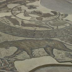
Corinium Dobunnorum
302 m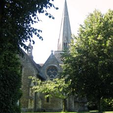
Church of the Holy Trinity
213 m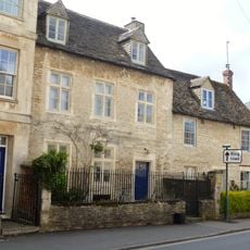
Chester Villa
368 m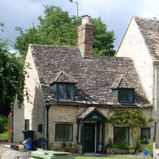
Rose Cottage
365 m
Cotswold Cottage
366 m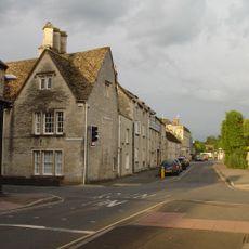
1, Querns Lane
415 m
Bowly's Cottages
351 m
50, 52 And 54, Chester Street
15 m
Gates, Doors, Piers And Attached Quadrants Of Wall To Watermoor House
205 m
Wall, Railings And Gate Pier Attached To Numbers 23 And 25
316 m
10, City Bank Road
395 m
St Johns Almshouses
404 m
2, Watermoor Road
405 m
12, City Bank Road
368 m
Watermoor House
171 m
Cirencester County Junior School
87 m
Lock Up In Grounds Of Cotswold District Council Offices
387 m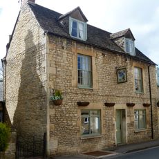
Twelve Bells And Attached Range Of Outbuildings
382 m
Former School And Attached Railings, Master's Houses, Gates And Gate Piers
389 m
86 And 86B, Dyer Street
419 m
Hare Sculpture
357 m
14, Lewis Lane
374 m
Walls Attached To Numbers 28-34
349 m
Bowly's Pump
346 m
Bowly's Almshouses
336 m
Wall And Gate Pier Attached To Numbers 16-26
312 m
The Prophet
261 m
32 Watermoor Road
215 mRecensioni
Ha visitato questo luogo? Tocchi le stelle per valutarlo e condividere la Sua esperienza o foto con la community! Provalo ora! Puoi annullarlo in qualsiasi momento.
Scopri tesori nascosti ad ogni viaggio!
Da piccoli caffè caratteristici a panorami nascosti, fuggi dalla folla e scova i posti che fanno davvero per te. La nostra app ti semplifica tutto: ricerca vocale, filtri furbi, percorsi ottimizzati e dritte autentiche da viaggiatori di tutto il mondo. Scaricala subito per vivere l'avventura sul tuo smartphone!

Un nuovo approccio alla scoperta turistica❞
— Le Figaro
Tutti i luoghi che meritano di essere esplorati❞
— France Info
Un’escursione su misura in pochi clic❞
— 20 Minutes