
Former Simpson Street Secondary School
Former Simpson Street Secondary School, school building in Sunderland, Tyne and Wear, UK
Posizione: Sunderland
Coordinate GPS: 54.91132,-1.39786
Ultimo aggiornamento: 25 novembre 2023 alle 01:30
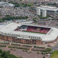
Stadium of Light
710 m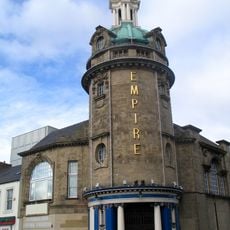
Sunderland Empire Theatre
779 m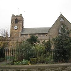
Sunderland Minster
843 m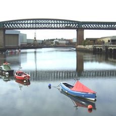
Queen Alexandra Bridge
587 m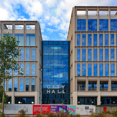
City Hall, Sunderland
841 m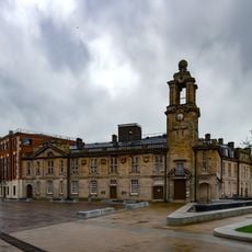
New Sunderland Square
841 m
Church of St Joseph
797 m
Church of St Mark
585 m
Websters Public House
352 m
The Dun Cow Public House
808 m
Magistrates' Court
795 m
Greens Public House
812 m
Mountain Daisy Public House
632 m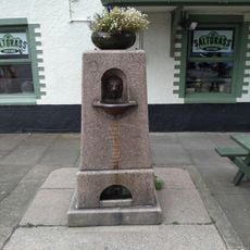
Drinking Fountain To West Of Saltgrass Public House
319 m
Livingstone's Public House
610 m
Websters Ropery
350 m
Former Gas Board Offices With Walls And Piers Attached
758 m
Lime Kilns On North Bank Of River Wear At Nz 3895 5826
728 m
1-7, High Street West
782 m
Gan Canny
786 m
Men of Steel
550 m
Millfield Cinema
530 m
Coal Staithe At Wearmouth Collery
456 m
Wearmouth Pit Wheel
577 m
Keel Line
826 m
Former North Eastern Railway Stables
629 m
Opera d'arte, scultura
727 m
The King's Arms Public House
267 mRecensioni
Ha visitato questo luogo? Tocchi le stelle per valutarlo e condividere la Sua esperienza o foto con la community! Provalo ora! Puoi annullarlo in qualsiasi momento.
Scopri tesori nascosti ad ogni viaggio!
Da piccoli caffè caratteristici a panorami nascosti, fuggi dalla folla e scova i posti che fanno davvero per te. La nostra app ti semplifica tutto: ricerca vocale, filtri furbi, percorsi ottimizzati e dritte autentiche da viaggiatori di tutto il mondo. Scaricala subito per vivere l'avventura sul tuo smartphone!

Un nuovo approccio alla scoperta turistica❞
— Le Figaro
Tutti i luoghi che meritano di essere esplorati❞
— France Info
Un’escursione su misura in pochi clic❞
— 20 Minutes