
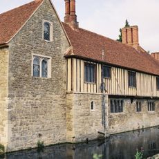
The Bank, architectural structure in Ightham, Tonbridge and Malling, Kent, UK
Posizione: Ightham
Coordinate GPS: 51.28677,0.28633
Ultimo aggiornamento: 25 novembre 2023 alle 01:30
Church of St Peter
274 m
Old Forge House
74 m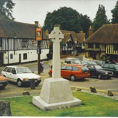
Ightham War Memorial
94 m
Old Stones
86 m
The Old Forge
178 m
Petts Cottage
27 m
The Chequers Public House
38 m
The George And Dragon Public House
54 m
Bank House
55 m
Tudor Cottage
62 m
Sycamore Cottage
63 m
Stone Cottage
21 m
The Town House
85 m
Bank Cottages
20 m
Stone House
17 m
Ightham Place
94 m
Hortondene The Gallery
24 m
Table Tomb In Churchyard Of Church Of St Peter 15 Yards South Of South Porch
250 m
Chest Tomb 10 Yards South Of South Porch
253 m
Chest Tomb 20 Yards North West Of Church Of St Peter
255 m
Chest Tomb 15 Yards North West Of Church Of St Peter
257 m
Chest Tomb 5 Yards South Of Church Of St Peter
260 m
Chest Tomb 10 Yards North West Of Church Of St Peter
263 m
Chest Tomb 10 Yards East Of Church Of St Peter
273 m
Bank Cottage
14 m
Bailey Tomb, 10 Yards North East Of Church Of St Peter
282 m
Church Cottage
287 m
Methodist Chapel
294 mRecensioni
Ha visitato questo luogo? Tocchi le stelle per valutarlo e condividere la Sua esperienza o foto con la community! Provalo ora! Puoi annullarlo in qualsiasi momento.
Scopri tesori nascosti ad ogni viaggio!
Da piccoli caffè caratteristici a panorami nascosti, fuggi dalla folla e scova i posti che fanno davvero per te. La nostra app ti semplifica tutto: ricerca vocale, filtri furbi, percorsi ottimizzati e dritte autentiche da viaggiatori di tutto il mondo. Scaricala subito per vivere l'avventura sul tuo smartphone!

Un nuovo approccio alla scoperta turistica❞
— Le Figaro
Tutti i luoghi che meritano di essere esplorati❞
— France Info
Un’escursione su misura in pochi clic❞
— 20 Minutes