
Farm Buildings Adjoining Bradbourne Farmhouse
Farm Buildings Adjoining Bradbourne Farmhouse, farmhouse in Sevenoaks, Sevenoaks, Kent, UK
Posizione: Sevenoaks
Coordinate GPS: 51.28657,0.18107
Ultimo aggiornamento: 25 novembre 2023 alle 01:30
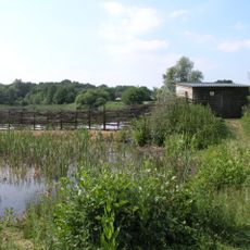
Sevenoaks Wildlife Reserve
544 m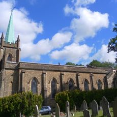
Church of St Mary
770 m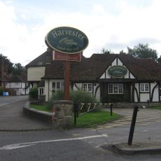
The Riverhead Public House
820 m
Vale Lodge
425 m
Bradbourne Farmhouse
58 m
Bradbourne Vale House
485 m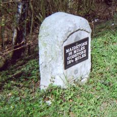
Milestone, Bradbourne Vale Road, W of railway bridge
292 m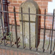
Milestone, Amherst Hill, Riverhead, nr jct with Worships Hill
813 m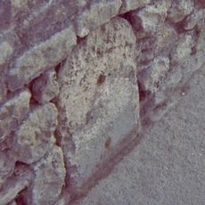
Milestone, Bradbourne Vale Road, just E of jct with Betenson Avenue
593 m
6, Amherst Hill
797 m
1-4, Linden Square
828 m
Linden Cottage
793 m
8, Amherst Hill
796 m
Barrow Way Barroway
754 m
7, Linden Square
803 m
Granite Column In Rear Garden Of Number 5
467 m
The Clock House
383 m
Amherst Cottage
821 m
3 And 5, Maidstone Road
786 m
Wall To West Of The Riverhead Public House
840 m
Wall Running Along Road South Of Turning To Montreal Road
844 m
7, The Square
860 m
Wall Running East-West To Form The South Boundary Of Lands Of The Riverhead Public House
862 m
8, The Square
863 m
Dovecot In Garden To West Of The Riverhead Public House
872 m
Minerva House
875 m
Riverhead House
878 m
Cade House
882 mRecensioni
Ha visitato questo luogo? Tocchi le stelle per valutarlo e condividere la Sua esperienza o foto con la community! Provalo ora! Puoi annullarlo in qualsiasi momento.
Scopri tesori nascosti ad ogni viaggio!
Da piccoli caffè caratteristici a panorami nascosti, fuggi dalla folla e scova i posti che fanno davvero per te. La nostra app ti semplifica tutto: ricerca vocale, filtri furbi, percorsi ottimizzati e dritte autentiche da viaggiatori di tutto il mondo. Scaricala subito per vivere l'avventura sul tuo smartphone!

Un nuovo approccio alla scoperta turistica❞
— Le Figaro
Tutti i luoghi che meritano di essere esplorati❞
— France Info
Un’escursione su misura in pochi clic❞
— 20 Minutes