
Farm Buildings Approximately 15 Metres South Of Mulberry Tree Hall
Farm Buildings Approximately 15 Metres South Of Mulberry Tree Hall, agricultural structure in Harescombe, Stroud, Gloucestershire, UK
Posizione: Harescombe
Coordinate GPS: 51.80647,-2.23432
Ultimo aggiornamento: 25 novembre 2023 alle 01:31
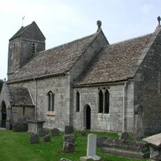
St Swithun's Church, Brookthorpe
446 m
Range Farm Fields
1.5 km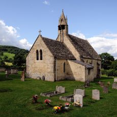
Church of St John the Baptist
1.6 km
Unidentified Monument In The Churchyard Approximately 1 Metre South Of Smith Monument To South Of Church Of St Swithin
490 m
Unidentified Monument In The Churchyard Approximately 1 Metre South Of Church Of St John And To West Of Porch
1.6 km
Springs Cottage
742 m
Lewis Monument In The Churchyard Approximately 1 Metre South Of Church Of St John And To East Of Porch
1.6 km
Weyman Monument In The Churchyard Approximately 2 Metres South Of Church Of St Swithin
495 m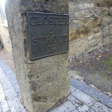
Milestone
1.3 km
Brookthorpe Court
502 m
Hilles House And Terraced Gardens
1.2 km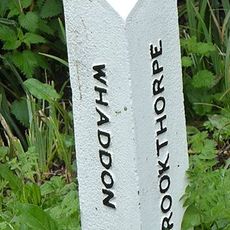
Boundary Post
918 m
Mulberry Tree Hall And Garden Wall
38 m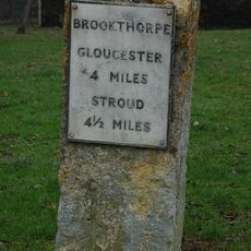
Milestone, Brookthorpe, opp. Fagins PH
300 m
Bacchus
843 m
Styles Farmhouse
676 m
Gilbert's
892 m
Grange Farmhouse
546 m
Brentlands Farmhouse With Railings And Piers
510 m
Browning Monument In The Churchyard Approximately 3 Metres South Of Porch To Church Of St Swithin
496 m
Podgwell Barn
1.4 km
Smith Monument In The Churchyard Approximately 5 Metres South Of Church Of St Swithin
493 m
Church Farmhouse
1.5 km
Cascata
1.6 km
Browning (Sic) Monument In The Churchyard Approximately 4 Metres South Of Porch To Church Of St Swithin
493 m
Biddle Monument In The Churchyard Approximately 4 Metres South Of Chancel To Church Of St John
1.6 km
Unidentified Monument In The Churchyard Approximately 1 Metre South Of Biddle Monument To South Of Church Of St John
1.6 km
Old Vicarage
452 mRecensioni
Ha visitato questo luogo? Tocchi le stelle per valutarlo e condividere la Sua esperienza o foto con la community! Provalo ora! Puoi annullarlo in qualsiasi momento.
Scopri tesori nascosti ad ogni viaggio!
Da piccoli caffè caratteristici a panorami nascosti, fuggi dalla folla e scova i posti che fanno davvero per te. La nostra app ti semplifica tutto: ricerca vocale, filtri furbi, percorsi ottimizzati e dritte autentiche da viaggiatori di tutto il mondo. Scaricala subito per vivere l'avventura sul tuo smartphone!

Un nuovo approccio alla scoperta turistica❞
— Le Figaro
Tutti i luoghi che meritano di essere esplorati❞
— France Info
Un’escursione su misura in pochi clic❞
— 20 Minutes