
Forstal Farmhouse, farmhouse in Headcorn, Maidstone, Kent, UK
Posizione: Headcorn
Coordinate GPS: 51.16412,0.61304
Ultimo aggiornamento: 25 novembre 2023 alle 01:32
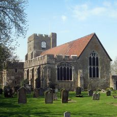
St Peter's and St Paul's Church, Headcorn
567 m
The Institute
715 m
Hubble's Stores Post Office
737 m
Trumpeter
473 m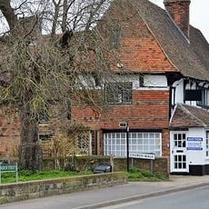
Cloth Hall
685 m
Headcorn Manor
553 m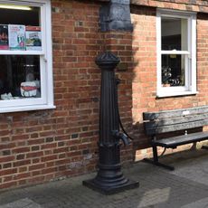
Pump Adjacent To No 30
764 m
1 and 2, Moat Road
718 m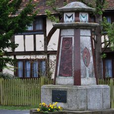
Headcorn War Memorial
706 m
Chequers
698 m
Milestone, Mill Bank, N of Bankfields and the bench
774 m
Table tomb about 5 metres south of South Chapel of Church of St Peter and St Paul
570 m
Glebe Cottage Heron Cottage Church Cottage
610 m
6-18, High Street
669 m
1,2,3,4, Church Walk
672 m
The Moat
640 m
Shakespeare House And Path Between Front Door And High Street
685 m
The Kings Arms Inn And Shop Adjoining To Right
690 m
9 and 10, Church Walk
623 m
Mortley And The Village Shop
701 m
Petite Cottage, Bless Cottage And Weavers Cottage
642 m
The Old Vicarage
714 m
Stephens Bridge
596 m
Table tomb about 10 metres east of Chancel of Church of St Peter and St Paul
587 m
21-25, High Street
728 m
Table tomb about 2 metres south of the south chapel of Church of St Peter and St Paul
566 m
Table tomb about 5 metres south of South Porch of Church of St Peter and St Paul
553 m
31, High Street
769 mRecensioni
Ha visitato questo luogo? Tocchi le stelle per valutarlo e condividere la Sua esperienza o foto con la community! Provalo ora! Puoi annullarlo in qualsiasi momento.
Scopri tesori nascosti ad ogni viaggio!
Da piccoli caffè caratteristici a panorami nascosti, fuggi dalla folla e scova i posti che fanno davvero per te. La nostra app ti semplifica tutto: ricerca vocale, filtri furbi, percorsi ottimizzati e dritte autentiche da viaggiatori di tutto il mondo. Scaricala subito per vivere l'avventura sul tuo smartphone!

Un nuovo approccio alla scoperta turistica❞
— Le Figaro
Tutti i luoghi che meritano di essere esplorati❞
— France Info
Un’escursione su misura in pochi clic❞
— 20 Minutes