
Pope's Hall, architectural structure in Hartlip, Swale, Kent, UK
Posizione: Hartlip
Coordinate GPS: 51.34864,0.64122
Ultimo aggiornamento: 25 novembre 2023 alle 01:32
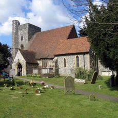
Church of St Michael
137 m
Tombs Of Adam And Richard Ruck, 5 Yards South East Of Porch Of Church Of St Michael
144 m
Ivy Cottage
484 m
Barrows Cottages
403 m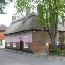
Thatch Cottage
128 m
Grace Cottages
596 m
Hartlip Place
584 m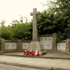
Hartlip War Memorial
192 m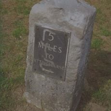
Milestone, between jcts of A20 with South Bush Lane and A20 with Seymour Road
1.5 km
Farm Storage Building 25 Yards South East Of Place Farm
659 m
Breach Farmhouse
1.5 km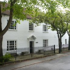
Hartlip House
143 m
The Cowls The Oast The Press
1.5 km
Dovecot 30 Yards West Of Place Farm
633 m
Barn 30 Yards North West Of Place Farm
590 m
Place Farmhouse Garden Wall And Granary
595 m
Yew Tree Cottage
381 m
7 Paradise Cottages And The Old Farmhouse
304 m
Sweepstakes Farmhouse
677 m
Nunwell Farmhouse
1.3 km
Barn 20 Yards South West Of Nunwell Farmhouse
1.3 km
Breach House
1.4 km
Stepp House
251 m
Tomb Of Mary Osborne, 3 Feet East Of South Chapel Of Church Of St Michael
132 m
Chesley House
1.5 km
Wisteria Cottage
98 m
Pond Farmhouse
1.5 km
Moor Street House
1.6 kmRecensioni
Ha visitato questo luogo? Tocchi le stelle per valutarlo e condividere la Sua esperienza o foto con la community! Provalo ora! Puoi annullarlo in qualsiasi momento.
Scopri tesori nascosti ad ogni viaggio!
Da piccoli caffè caratteristici a panorami nascosti, fuggi dalla folla e scova i posti che fanno davvero per te. La nostra app ti semplifica tutto: ricerca vocale, filtri furbi, percorsi ottimizzati e dritte autentiche da viaggiatori di tutto il mondo. Scaricala subito per vivere l'avventura sul tuo smartphone!

Un nuovo approccio alla scoperta turistica❞
— Le Figaro
Tutti i luoghi che meritano di essere esplorati❞
— France Info
Un’escursione su misura in pochi clic❞
— 20 Minutes