
Granary At Manor Farm, granary in Cherhill, Wiltshire, UK
Posizione: Cherhill
Coordinate GPS: 51.44351,-1.90955
Ultimo aggiornamento: 25 novembre 2023 alle 01:32
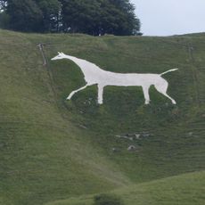
Cavallo Bianco di Cherhill
2.5 km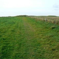
Windmill Hill
2.6 km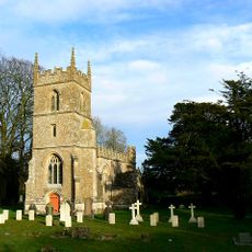
Church of All Saints
132 m
Pair of round barrows 200m SSE of Windmill Hill: part of the Windmill Hill round barrow cemetery.
2.6 km
Bowl barrow 200m south of Windmill Hill: part of the Windmill Hill round barrow cemetery.
2.4 km
A causewayed enclosure, the core of a round barrow cemetery, part of a prehistoric field system and an associated mortuary enclo
2.3 km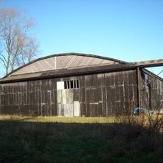
Two Former Hangars On North Side Of Former Airfield
1.1 km
Horslip long barrow, 450m north-west of Horslip Bridge.
2.5 km
Pair of bowl barrows on West Down, 550m east of Witch Plantation
2.6 km
Nolands Farmhouse
865 m
Bowl barrow 200m east of Windmill Hill: part of the Windmill Hill round barrow cemetery.
2.7 km
Upper Farmhouse
2.6 km
The Manor House
64 m
Bowl barrow 350m north-east of White Horse Plantation
2 km
Pair of round barrows and section of linear earthwork NE of the gallops on West Down
2.5 km
Tudor Thatch
218 m
Cross dyke 520m north east of Cherhill Monument
2.3 km
Former Hangar At North East Corner Of Former Airfield
711 m
Bowl barrow 190m north east of Nolands Farm, Yatesbury
697 m
Combined Officers Mess And Offices, Yatesbury Airfield
1.3 km
Round barrow in Mount Wood, 300m north-east of Upper Lodge
2.7 km
Two bowl barrows 320m south-east of Little London
912 m
The Old Rectory
571 m
Yatesbury House Farmhouse
494 m
Linear boundary earthwork and associated field system on Cherhill Down
2.1 km
Manor House
144 m
Bowl barrow 400m west of Cooks Plantation
2 km
Three Monuments In Churchyard South Of Chancel Of Church Of All Saints
136 mRecensioni
Ha visitato questo luogo? Tocchi le stelle per valutarlo e condividere la Sua esperienza o foto con la community! Provalo ora! Puoi annullarlo in qualsiasi momento.
Scopri tesori nascosti ad ogni viaggio!
Da piccoli caffè caratteristici a panorami nascosti, fuggi dalla folla e scova i posti che fanno davvero per te. La nostra app ti semplifica tutto: ricerca vocale, filtri furbi, percorsi ottimizzati e dritte autentiche da viaggiatori di tutto il mondo. Scaricala subito per vivere l'avventura sul tuo smartphone!

Un nuovo approccio alla scoperta turistica❞
— Le Figaro
Tutti i luoghi che meritano di essere esplorati❞
— France Info
Un’escursione su misura in pochi clic❞
— 20 Minutes