
Pant, building in Blanchland, Northumberland, UK
Posizione: Blanchland
Coordinate GPS: 54.84788,-2.05472
Ultimo aggiornamento: 16 novembre 2025 alle 05:44
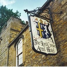
The Lord Crewe Arms Hotel
27 m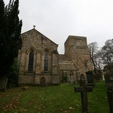
Blanchland Abbey
68 m
Church of St Mary
71 m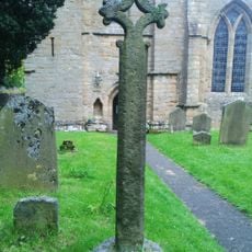
Churchyard Cross 17 Metres West Of Door Of Church Of St. Mary
70 m
Privies To Rear Of No. 13, 14 And Gowland's Cottage
68 m
Abbey View
57 m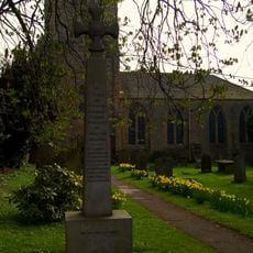
War Memorial Outside St Marys Abbey
59 m
Bridge Over The Shildon Burn
57 m
Blanchland Bridge, Over The River Derwent
79 m
3-6, The Square
24 m
7-9, The Square
33 m
Byre And Attached Privies 10 Metres South-South-West Of Abbey View
50 m
Abbey Gatehouse With Post Office
29 m
Ward Headstone 12 Metres South-West Of Door Of Church Of St. Mary
60 m
11 And 12, The Square
47 m
10, The Square
50 m
Byre/Hayloft 10 Metres South-East Of No.10
68 m
13 And 14, The Square
53 m
Outbuilding And Attached Privies 5 Metres East Of No.17
66 m
The Angel
21 m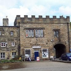
House Adjacent To Abbey Gatehouse
33 m
No. 17 And Adjacent Building To West, Now A Wing Of Lord Crewe Arms
30 m
Barn 6 Metres West Of Abbey View
63 m
Telephone Kiosk Opposite Abbey Church
38 m
Farmbuidlings To South Of No. 10
66 m
Gowland's Cottage
52 m
Gatepiers To Churchyard
57 m
Wall on South Side of Churchyard
47 mRecensioni
Ha visitato questo luogo? Tocchi le stelle per valutarlo e condividere la Sua esperienza o foto con la community! Provalo ora! Puoi annullarlo in qualsiasi momento.
Scopri tesori nascosti ad ogni viaggio!
Da piccoli caffè caratteristici a panorami nascosti, fuggi dalla folla e scova i posti che fanno davvero per te. La nostra app ti semplifica tutto: ricerca vocale, filtri furbi, percorsi ottimizzati e dritte autentiche da viaggiatori di tutto il mondo. Scaricala subito per vivere l'avventura sul tuo smartphone!

Un nuovo approccio alla scoperta turistica❞
— Le Figaro
Tutti i luoghi che meritano di essere esplorati❞
— France Info
Un’escursione su misura in pochi clic❞
— 20 Minutes