Home Farm, agricultural structure in Guildford, Surrey, UK
Posizione: Guildford
Coordinate GPS: 51.24272,-0.56697
Ultimo aggiornamento: 25 novembre 2023 alle 01:32
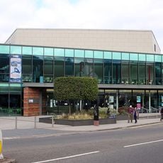
G Live
520 m
Stoke Park
257 m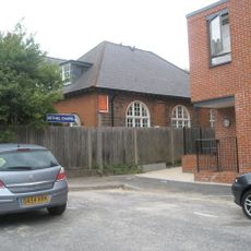
Bethel Chapel Guildford
584 m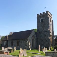
Church of St John the Evangelist
561 m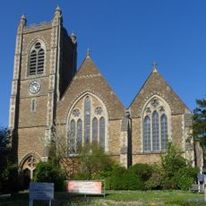
Christ Church
540 m
Whitman And Parker, Solicitors
575 m
Waterden Cottage
499 m
Urn, Approximately 10 Metres North West Of Church Of St John The Evangelist
587 m
Heath And Salter, Estate Agents
618 m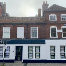
244, 246 And 246A, High Street
632 m
Parson's Almshouses
301 m
2, Stoke Road
514 m
Juno
453 m
The Stoke Hotel
319 m
Cedar
525 m
Opera d'arte
511 m
Bowden Cottage The Rowans
477 m
Parson Tomb Approximately 5 Metres North Of Church Of St John The Evangelist
574 m
Key House
469 m
Percy Place Regency Cottage
576 m
29, Chertsey Street
578 m
Stoke next Guildford War Memorial
514 m
Entrance Walls And Side Buildings At The Parson's Almshouses
311 m
274 And 276, High Street
588 m
Remnants
606 m
78, Stoke Road
308 m
248 And 250, High Street
627 m
Home Farm House
30 mRecensioni
Ha visitato questo luogo? Tocchi le stelle per valutarlo e condividere la Sua esperienza o foto con la community! Provalo ora! Puoi annullarlo in qualsiasi momento.
Scopri tesori nascosti ad ogni viaggio!
Da piccoli caffè caratteristici a panorami nascosti, fuggi dalla folla e scova i posti che fanno davvero per te. La nostra app ti semplifica tutto: ricerca vocale, filtri furbi, percorsi ottimizzati e dritte autentiche da viaggiatori di tutto il mondo. Scaricala subito per vivere l'avventura sul tuo smartphone!

Un nuovo approccio alla scoperta turistica❞
— Le Figaro
Tutti i luoghi che meritano di essere esplorati❞
— France Info
Un’escursione su misura in pochi clic❞
— 20 Minutes