Forsters, building in West Malling, Tonbridge and Malling, Kent, UK
Posizione: West Malling
Coordinate GPS: 51.29308,0.40752
Ultimo aggiornamento: 23 novembre 2025 alle 09:54
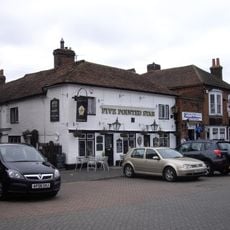
Five Pointed Star Public House
78 m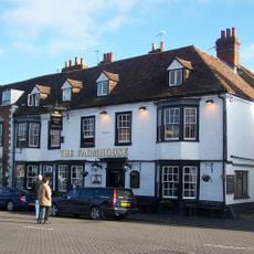
Bear Hotel
91 m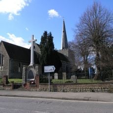
West Malling War Memorial
95 m
104, High Street
65 m
106, High Street
56 m
Milverton House
17 m
Lucknow
32 m
Old Vicarage
15 m
Town Pump Situated Opposite Old Vicarage
18 m
129, High Street
30 m
Tudor House
62 m
Church of St Mary Monument To James Godfrey Approximately 30 Metres North Of Chancel
92 m
K6 Telephone Kiosk
90 m
Railings To Parish Church Of St Mary The Virgin
91 m
107, High Street
65 m
103 And 105, High Street
71 m
110, High Street
41 m
Wistaria House
33 m
123, High Street
27 m
Street House
25 m
Tudor Cottage
48 m
Church House
82 m
Stable To The Vicarage (Vicarage Not Included)
54 m
115 And 117, High Street
37 m
Railings To Old Vicarage
13 m
Outbuilding To Rear Of Five Pointed Star Public House
65 m
108, High Street
48 m
101, High Street
76 mRecensioni
Ha visitato questo luogo? Tocchi le stelle per valutarlo e condividere la Sua esperienza o foto con la community! Provalo ora! Puoi annullarlo in qualsiasi momento.
Scopri tesori nascosti ad ogni viaggio!
Da piccoli caffè caratteristici a panorami nascosti, fuggi dalla folla e scova i posti che fanno davvero per te. La nostra app ti semplifica tutto: ricerca vocale, filtri furbi, percorsi ottimizzati e dritte autentiche da viaggiatori di tutto il mondo. Scaricala subito per vivere l'avventura sul tuo smartphone!

Un nuovo approccio alla scoperta turistica❞
— Le Figaro
Tutti i luoghi che meritano di essere esplorati❞
— France Info
Un’escursione su misura in pochi clic❞
— 20 Minutes