Clarendon, building in Battle, Rother, East Sussex, UK
Posizione: Battle
Coordinate GPS: 50.92219,0.48085
Ultimo aggiornamento: 21 novembre 2025 alle 05:04
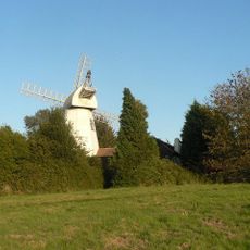
King's Head Mill
264 m
The Cottage
354 m
Friars Holt
300 m
26 And 26A, Mount Street
522 m
The Old Court House
422 m
31, Mount Street
546 m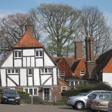
Lewins Croft
481 m
7 And 8, Mount Street
541 m
13, Mount Street
521 m
18, Mount Street
445 m
Mountview
353 m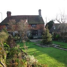
The Almonry
528 m
10, 11 And 12, Mount Street
526 m
15, 16 And 17, Mount Street
454 m
Barrack Farmhouse
511 m
The Garden Walls And Gate Piers Of The Almonry To The North West Of The House
497 m
19 And 20, Mount Street
439 m
43, High Street
542 m
9, Mount Street
535 m
The Zion Chapel
498 m
The Hollies Presbytery
510 m
Bryddes
480 m
27 And 27A, Mount Street
529 m
Gaynes
142 m
1 and 2, Wattles Wish
290 m
Statua, opera d'arte
420 m
Opera d'arte, scultura
503 m
Punto di vista panoramico
231 mRecensioni
Ha visitato questo luogo? Tocchi le stelle per valutarlo e condividere la Sua esperienza o foto con la community! Provalo ora! Puoi annullarlo in qualsiasi momento.
Scopri tesori nascosti ad ogni viaggio!
Da piccoli caffè caratteristici a panorami nascosti, fuggi dalla folla e scova i posti che fanno davvero per te. La nostra app ti semplifica tutto: ricerca vocale, filtri furbi, percorsi ottimizzati e dritte autentiche da viaggiatori di tutto il mondo. Scaricala subito per vivere l'avventura sul tuo smartphone!

Un nuovo approccio alla scoperta turistica❞
— Le Figaro
Tutti i luoghi che meritano di essere esplorati❞
— France Info
Un’escursione su misura in pochi clic❞
— 20 Minutes