
Home Farmhouse, farmhouse in Arundel, Arun, West Sussex, UK
Posizione: Arundel
Coordinate GPS: 50.86010,-0.55480
Ultimo aggiornamento: 25 novembre 2023 alle 01:41
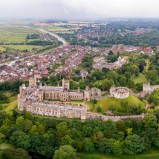
Castello di Arundel
451 m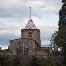
Fitzalan Chapel
481 m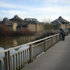
WWT Arundel
362 m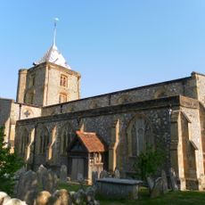
Church of St Nicholas
501 m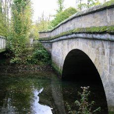
Bridge
80 m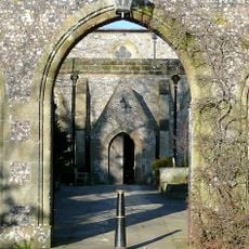
St Nicholas Church Gateway
540 m
69, High Street
553 m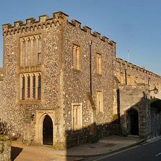
The Priory (st Wilfred's)
541 m
Walls Of Churchyard Of St Nicholas Church Immediately Flanking The Gateway
543 m
Raised Pavement In Front Of Tower House Including Railings
559 m
St Marys Gate
496 m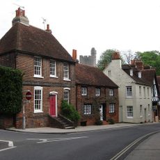
8, Maltravers Street
570 m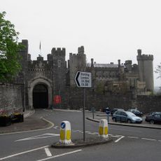
Town Gate And Castle Walls
501 m
Greenhouses
536 m
Wall of Tower House to North and East of Garden and of No 14 Maltravers Street Continuing to West of Toewr House as Far as Parsons Hill
551 m
Swanbourne Lodge At Arundel Park
239 m
Arundel Priory Playhouse
543 m
Retaining Walls To Pools Either Side Of Pumping House At Home Farm
44 m
71, High Street
545 m
Pavement Leading To The Churchyard Of Church Of St Nicholas
551 m
Deer Barn Attached To Se End Of The Racing Stables
459 m
Ornamental Dairy To North Of Home Farmhouse
36 m
Pumping House To North Of Farm Buildings At Home Farm
19 m
2 And 4, Maltravers Street
561 m
Arundel Park House, Including Garden Walls And Terrace
565 m
6, Maltravers Street
566 m
67, High Street
568 m
Farm Buildings To North Of Dairy At Home Farm
1 mRecensioni
Ha visitato questo luogo? Tocchi le stelle per valutarlo e condividere la Sua esperienza o foto con la community! Provalo ora! Puoi annullarlo in qualsiasi momento.
Scopri tesori nascosti ad ogni viaggio!
Da piccoli caffè caratteristici a panorami nascosti, fuggi dalla folla e scova i posti che fanno davvero per te. La nostra app ti semplifica tutto: ricerca vocale, filtri furbi, percorsi ottimizzati e dritte autentiche da viaggiatori di tutto il mondo. Scaricala subito per vivere l'avventura sul tuo smartphone!

Un nuovo approccio alla scoperta turistica❞
— Le Figaro
Tutti i luoghi che meritano di essere esplorati❞
— France Info
Un’escursione su misura in pochi clic❞
— 20 Minutes